Hike #1367
June 20, 2018
Jones Peak via Bailey Canyon Trail
Hike Leader: Tom Kaczmarek
Meet 9:00 am for start at 9:30 am
Please print your own hike descriptions and maps. This will avoid the inconvenience and save costs to the hike leader.
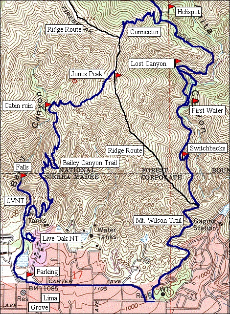
GPS Data:
Basic Hike: 6.6 mi. RT, cum. elevation gain = 2,400 ft.
Connector Trail Loop Option: 8.1 mi. RT, cum. elevation gain = 2800 ft.
Jones Ridge Loop Option: 6.5 mi. RT, cum. elevation gain = 2,550 ft.
Directions to Trailhead: From the 210 Freeway take the Michillinda Blvd. off-ramp, in Arcadia, and go north on Michillinda. After about 1.2 miles turn right (east) at Grandview. Turn left (north) at the third street, Grove. Grove will dead-end at Bailey Canyon Park. Go through the gate and park in the parking lot. If the lot is full there is plenty of parking along Grove just before the park entrance. There is a restroom in the park.
Basic Hike: Up and back on the Bailey Canyon Trail to Jones Peak. It is not an easy hike, it is steep, but the trail is in good condition.
Connector Trail Loop Option: From the saddle below Jones Peak head north a quarter mile to the junction of the Connector trail. Take that down almost a mile to the Wilson trail turn right and head down to the Mount Wilson Trail Park. Go west on Carter Ave about 0.75 miles to the Bailey Canyon trail parking.
Jones Ridge Loop Option: Exit the parking lot and walk 0.75 miles east along Carter Avenue to the beginning of the Mt. Wilson Trail. Hike up the trail about a mile to the unmarked junction of the Jones Ridge Route Trail. The trail route follows the ridge all the way to the summit of Jones Peak. The lower part of the trail has easy switchbacks for a while, but then it is a straight up scramble about a mile and 1,735 feet elevation gain. Return via the Bailey Canyon Trail back down to the parking lot.
Shorter Options:
1) Hike up the Bailey Canyon trail for 2.2 miles (one way) and 1,350 feet elevation gain to the Old Cabin site. All that is left of the cabin are some low stone walls. It is shady there and a short trail leads down to the stream with lots of trees.
2) Hike up the Canyon View Nature Trail, which goes to the falls. This trail branches off the Bailey Trail after 0.45 miles with a total distance to the falls one way from the Park of about 0.75 miles and 300 feet gain.
3) Another short loop that could be combined with the Falls Trail is the Live Oak Nature Trail, which begins by crossing a bridge 0.3 miles from the Park.
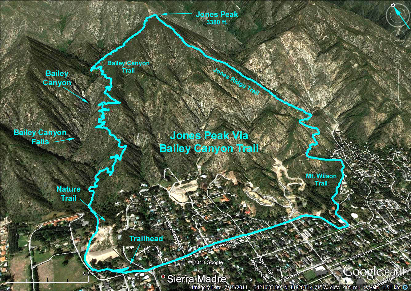
Google Earth Photo - Jones Peak via Bailey Canyon, and Mt. Wilson/Jones Ridge Trails
2018-05-01