Hike 1366
Santa Susana Pass State Historic Park
June 13, 2018
Hike Leader: Phil Rutherford
Meet at 9:00 am for start at 9:30 am
Please print your own hike descriptions and maps. This will avoid the inconvenience and save costs to the hike leader.
Directions to Trailhead:
From the 118. Go west on the 118. In Chatsworth, take the CA 27 Topanga Canyon off-ramp. Turn left (south) and continue on Topanga Canyon Blvd. Go 1.9 miles and turn right (west) on Lassen St. Go 0.75 miles on Lassen. Cross Baden Ave/Valley Circle and turn left on Andora Ave. The trailhead is less than 100 yards past the Oakwood Cemetery on the right. Park anywhere along Andora Ave. on either side of the street.
From the 101. Go west on the 101. In Woodland Hills, take the CA 27 Topanga Canyon off-ramp. Turn right (north) and continue on Topanga Canyon Blvd. Go 5.5 miles and turn left (west) on Lassen St. Follow directions above to Andora Ave. trailhead.
History: Santa Susana Pass State Historic Park - where the Simi Hills meet the Santa Susana Mountains - is rich in natural and cultural significance. Its largely undisturbed landscaped contains part of a historic transportation corridor between Missions San Buenaventura and San Fernando. The park’s Santa Susana Stage Road was once a segment of the famous Butterfield Overland Stage Route, and was also used by Wells, Fargo & Company as a route between Los Angeles and Santa Barbara. Park Brochure. Historic Overview.
Warning: The lower portion of SSPSHP from the Andora Ave. trailhead to the Lilac Lane trailhead is well sign posted. However, the upper loop is poorly signed. Although the map has named trails, do not expect to see these names on any trail signs. Use the hike description and map and check your mileage on your GPS devices.
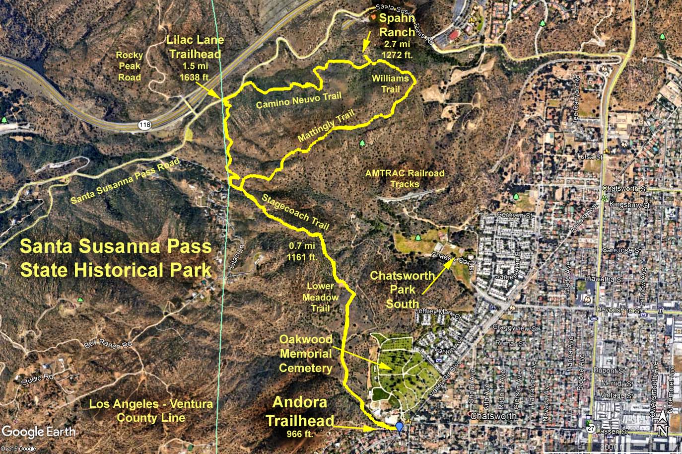
Basic Hike: RT 5.4 miles, elevation gain 1150 ft
- Head west on the Andora Trail for 0.3 miles. (Cumulative 0.0 miles, elevation 966 ft)
- Pass the Miranda Loop trail on your left. (Cumulative 0.3 miles)
- Continue north on the Andora Trail for another 0.15 miles until you reach a 3-leg fork. Take the center Lower Meadow Trail. (Cumulative 0.45 miles)
- After 0.25 miles, turn left onto the Old Santa Susana Stagecoach Road. (Cumulative 0.7 miles)
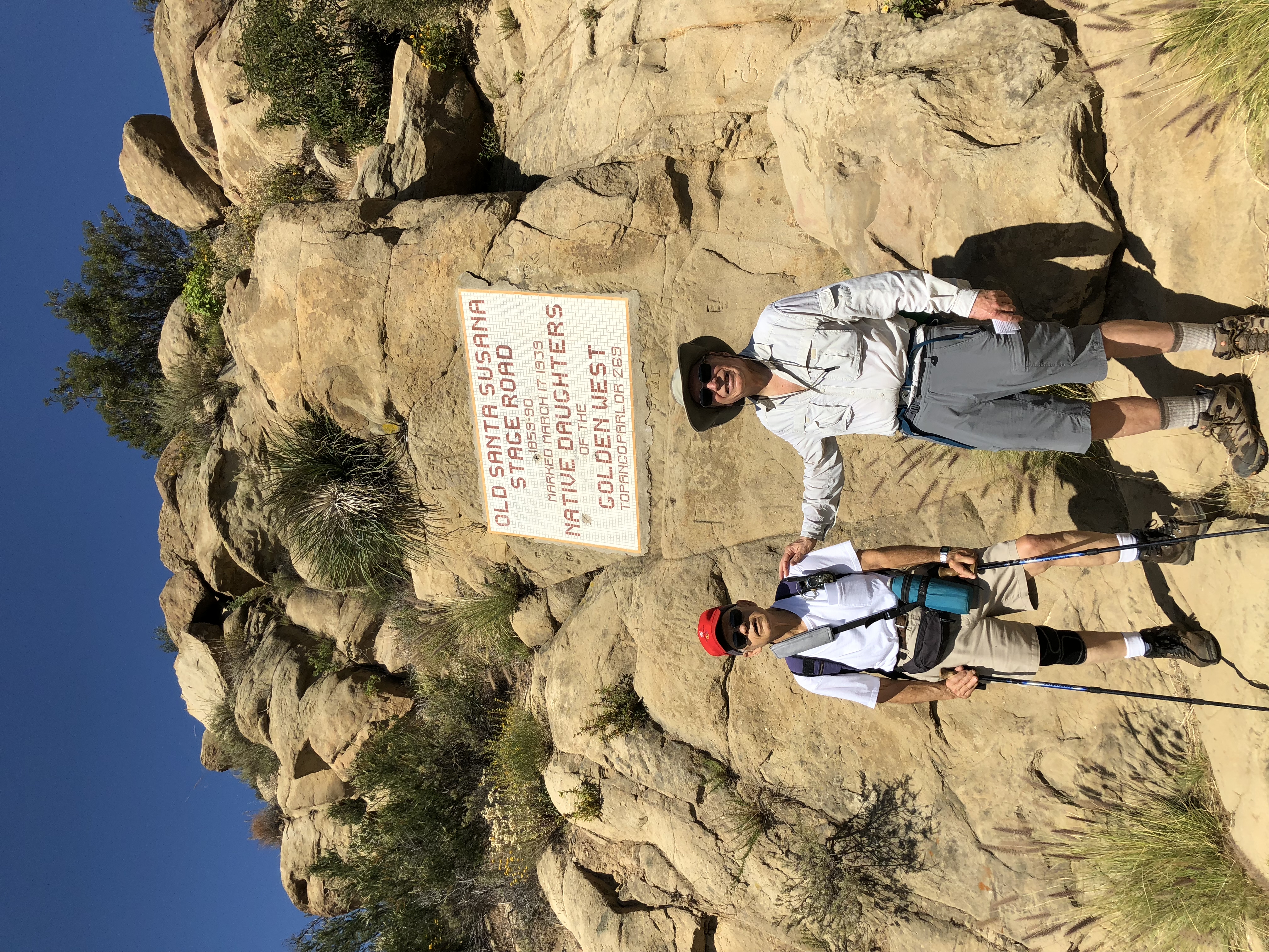
- Continue on the Old Santa Susana Stagecoach Road for 0.8 miles passing the Waterfall Trail on your left and the Upper Pond Trail on your left. This section of the hike is rocky and moderately steep. You will pass a sign celebrating the stagecoach road placed by the Native Daughters of the Golden West in 1939. (Cumulative 1.5 miles)
- Have a cookie break at the Lilac Lane trailhead. There is a restroom here. (Elevation 1638 ft)
- Head east on the Mattingly Trail for 100 yards, then take a sharp left up a straight trail leading up the hill.
- Countinue for 0.45 miles up and over a ridge (elevation 1785 ft). A view of Simi Valley is on the left. Continue down a steep rocky switchback to the Santa Susana Pass Road. (Cumulative 1.95 miles)
- Turn right on the Santa Susana Pass Road for about 0.1 miles and look for an unmarked trail with a gate off the road on your right. This is the El Camino Nuevo Trail. (Cumulative 2.05 miles)
- Continue for 0.25 miles on the El Camino Nuevo. Take the unmarked El Camino Nuevo trail off to your left with the stone pile “duck” on your right. (Cumulative 2.3 miles)
- Continue on the El Camino Nuevo for another 0.4 miles. The building foundation slabs and piping to your left are all that remains of the Spahn Ranch that was the home of the Manson cult and burned down in 1970. Take the trail to the left into the Ranch. This a good place for lunch. Those taking the extended hike (see below), look for an unmarked trail to the east that is a continuation of the El Camino Nuevo trail. Those wanting the basic hike, go back to the main trail, that is now called the Williams Trail. (Cumulative 2.7 miles)
- Continue on the Williams Trail for 0.3 miles until it turns south-west and becomes the Mattingly Trail. (Cumulative 3.0 miles)
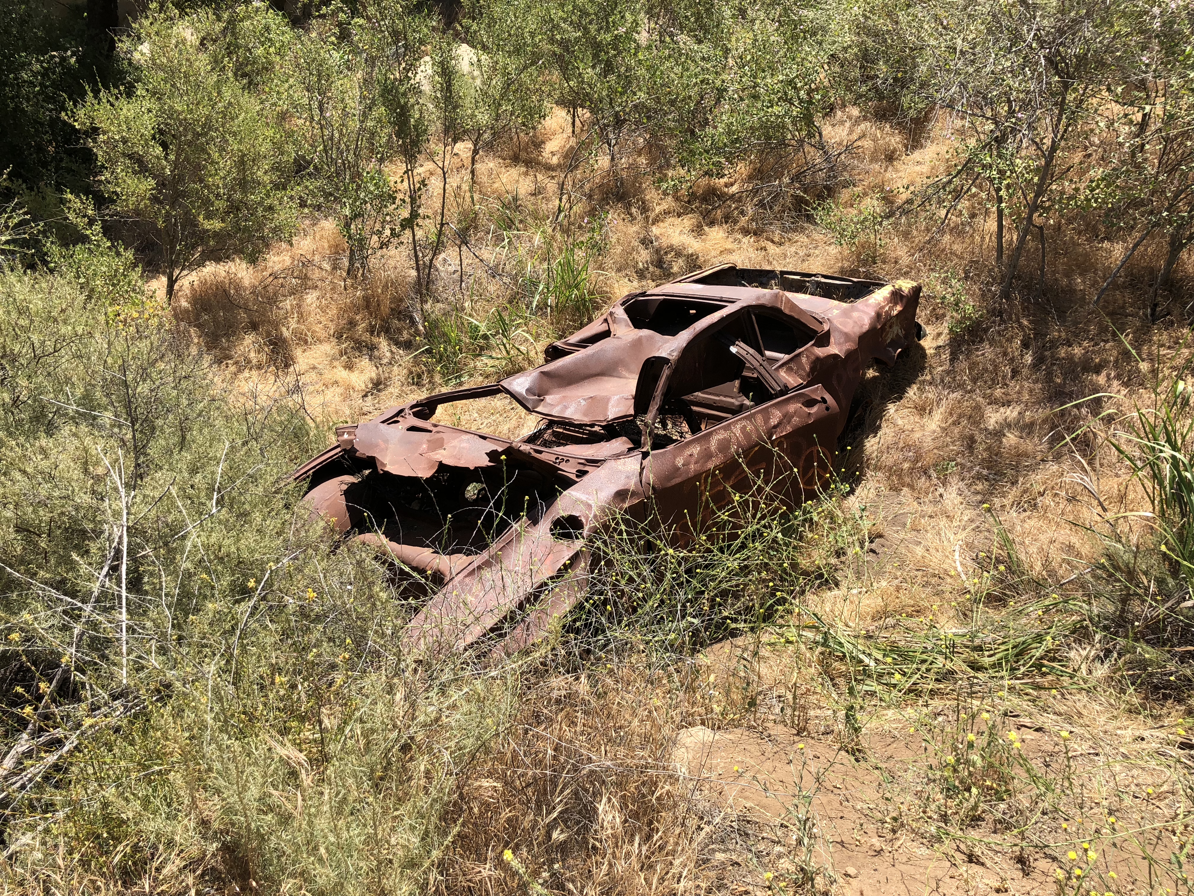
- Stay on the Mattingly Trail for 0.9 miles in a generally south-west direction, heading towards the homes until you reach the Lilac Lane trailhead. The first 0.2 miles of this section is overgrown (check for ticks) and moderately steep. Look out on your left for and old rusted car, that legend says belonged to Charles Manson’s cult. (Cumulative 3.9 miles)
- Retrace steps 6 to 1. (Cumulative 5.4 miles)
Extended Hike: RT 6.4 miles, elevation gain 1200 ft.
- From the Spahn Ranch, take the trail east through the canyon to the Santa Susana Road, then retrace your steps back to the Spahn Ranch and continue with steps 12 to 14 from the basic hike. Adds an extra 1.0 mile RT.
Medium Hike: Shortened Upper Loop. RT 4.45 miles.
- Steps 1 to 10.
- Bypass the stone “duck” to your left and continue on the main trail that becomes the Sanchez Trail.
- After 0.25 miles, turn right onto the unmarked Mattingly Trail.
- Continue for 0.5 miles to the Lilac Lane Trailhead.
- Retrace steps 6 to 1.
Short Hike: Andora Trailhead to Lilac Lane Trailhead and return. RT 3.0 miles. Elevation gain 672 ft.
- Steps 1 to 6.
- Retrace steps 6 to 1
Refreshments served at the Andora trailhead. Picnic tables and benches available. Restrooms at both the Andora and Lilac Lane trailheads.
Santa Susana Pass State Historic Park Map
Google Earth - SSPSHP
2018-06-11