Hike #1328
July 19, 2017
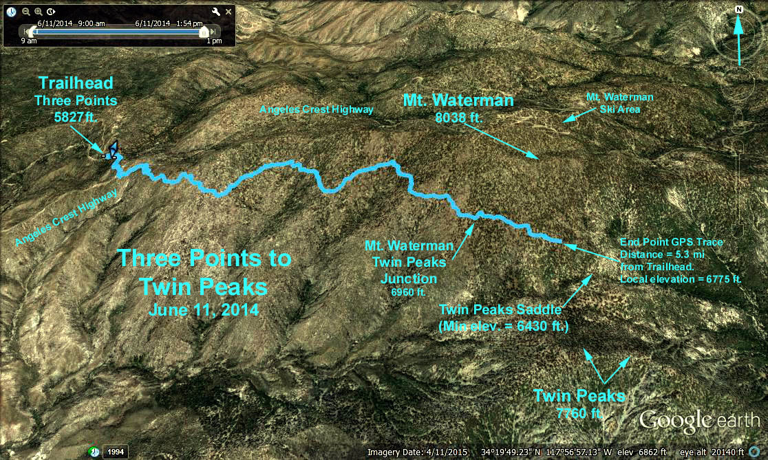
Three Points to Twin Peaks (or Waterman or Junction)
Trailhead Directions: The trailhead is at Three Points on the Angeles Crest Highway 29.4 miles from the 210 freeway at mile paddle 52.8. Turn left at Santa Clara Divide Road and continue to the parking area which soon appears on the left. There are toilets available at the parking lot.
The Hike: There are three options to this hike:
A: Shorter version. Go to the Mount Waterman/Twin peaks junction only.
Elev. at trailhead = 5,827 ft.
Elev. at junction = 6,960 ft.
Distance to junction = 4.7 miles one way, elev. gain = 1,273 ft.
Round Trip = 9.4 miles, elev. gain approx. 1,273 ft.
B: Onward to Twin Peaks from junction
Elev. at junction = 6,960 ft.
Min. elev. at Twin Peaks Saddle (stream) = 6,430 ft.
Elev. of Twin Peaks = 7,760 ft.
Total for round trip est. at 14 miles, elev. gain = 3,700 ft.
C: Onward to Waterman from junction
Elev. of Mt. Waterman = 8,038 ft
Total for round trip est. at 13.4 miles, elev. gain = 2,473 ft.
NOTE: For all hikes, the trail starts to the South across Angeles Crest Hwy. Initially you are on the Pacific Crest Trail but you want break off to the SE on the Mt. Waterman/Twin Peaks Trail rather than continue on the PCT which roughly parallels Angeles Crest Hwy in this area.
Google Earth - Three Points to Twin Peaks
2017-07-19