1327
OTP & OTHERS
Hiking & Debating Society
Grizzly Flat
July 12, 2017
This will be a dry shoe hike, there will be no stream crossings, and no rock hopping, no poison oak and the hike will be mostly on a fire road. The probability of injury or getting lost is near zero.
For the inveterate adventurers, there are a couple of unscouted alternate routes that follow a steeper trail and may provide a little more interest to those so inclined (no pun intended).
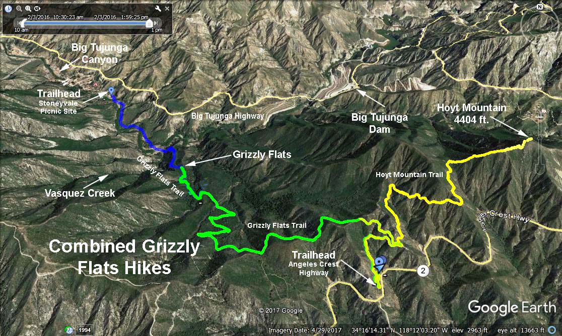
From the 210 freeway in La Canada drive north 6.2 miles on Angeles Crest Highway, (state route 2), to a parking area on the left (north) side of the road. The mileage paddle at the roadside will read 30.64. Park so that you don't block the fire road.
We will gain about 430 feet of elevation in the first mile, and then we will ascend an easy 80 feet to a saddle. We will cross the saddle and descend about 890 feet to Grizzly Flat. We will have an excellent view of Tujunga Canyon as we descend the escape route used by Tiburcio Vasquez on one his raids on the ranchers of early Los Angeles.
We will convene at the trailhead at 9:00 AM and with a few minutes waiting period for the slow pokes we will start the hike at 9:30 AM.
Google Earth - Combined Grizzly Flat (Yellow/Green Trace)
Trip (GPS) data:
Date July 12, 2017
Distance 6.7 miles, round trip
Elevation gain (cumulative) 2305 feet
Trailhead elevation 2985 feet
Effort Easy / Moderate
Leader Mike Gessner
Recommended Maps:
San Gabriel Valley Automobile Club
Angeles National Forest U S Forest Service
Condor Peak 7.5 minute Topographic
2017-07-27