Hike #1284
Cloudburst Summit to Cooper Canyon Campground
July 27, 2016
Dan Bergstrom, Hike Leader
Distance: 5.6 mile RT
Elevation Change: Caution: "Upside-down Hike": Approx. an 800 foot climb coming back. Longer versions are feasible and are described below.
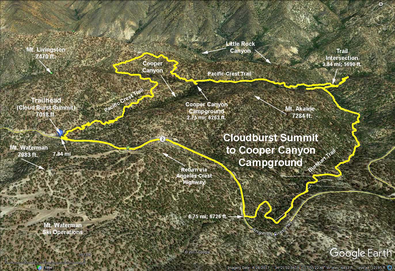
Cloudburst Summit is at an elevation of 7018 feet.
Trailhead Directions: Cloudburst Summit is at mileage paddle 57.04 on Angeles Crest Highway (32.6 miles from the 210 fwy.). Park along the road.
The Basic Hike: We will descend 2.8 miles and 765 feet to Cooper Canyon campground through beautiful country. The people doing the "regular" hike can have their (early) lunch here by the creek and then return up the same trail to the start.
Option 1: Those wanting a longer hike can hike along Cooper Creek another 1.1 miles and a drop of 573 more feet to the junction with the Burkhart Trail and turn around and go back the same way they came. This will result in a hike of 7.7 miles RT and an elevation gain/loss of 1328 feet.
Option 2: Another option would take the Burkhard trail back to the Angeles Crest Highway for the return to the trailhead. The total for the loop is 7.8 mi RT with a 1408 foot elevation gain/loss. This requires walking the highway for 1.1 miles with a 290 foot climb.
Refreshments at the trailhead.
Google Earth Photo - Cloudburst Summit to Cooper Canyon Campground (Mileages shown are cumulative from the trailhead, elevations are absolute).
2017-07-27