Hike #1263
Forrestal Reserve/Portuguese Bend Reserve
March 2, 2016
Anna Kuehl, Hike Leader
GPS Distance Data (Elevation data given below):
Trailhead to Eagle's Nest and return = 5 mi RT.
Trailhead up and over quarry, then ultimately out to del Cero park and return = 7.7 mi RT.
Directions to trailhead: Go south on Harbor Freeway (110). Exit left to Gaffey. Continue south to 25th Street. Turn right on 25th. Go approximately 3.4 miles to Forrestal Drive. Turn right on Forrestal Drive across from Trump National Golf Course. A barrier blocks the road just after the left turn for the Ladera Linda Community Center. Park on the roadside outside the gate or at the Center.
Alternate: Go south on Hawthorne Blvd. to Palos Verdes Drive South. Turn left on Palos Verdes Drive South, pass Portuguese Bend and turn left on Forrestal Drive. See above for additional parking instructions.
Hike alternatives:
Easy Hike (about 4.0 miles): Walk toward the end of Forrestal Drive and continue to follow the paved road to the left. Turn right on Purple Sage Trail just before the cul-de-sac, and follow the trail downward. After the trail crosses Klondike Canyon, bear right on Klondike Canyon Trail and follow it up a hill to Panorama Trail. When you reach the Sandbox Trail veer left to the Peppertree Trail. Continue on until you reach the Landslide Scarp Trail on the right. Turn right and continue on to Burma Road Trail. Turn right and right again on Panorama Trail to Klondike Canyon Trail. From there return to parking lot the way you came.
Moderate Hike (about 6 miles) Follow instructions to Peppertree Trail as for the Easy Hike. From there take Garden Trail (rather than Toyon Trail) past water tank and veer left on Water Tank Trail, right on Vanderlip Trail, right on Kubota Trail. When you reach the Water Tank Trail again, turn left and go to Burma Road Trail. Once you reach Burma Road Trail, turn right and again right on Panorama Trail to Klondike Canyon Trail and from there return to parking lot the way you came.
Difficult Hike (about 8 miles). From reserve entrance on Forestal Drive, take these trails: Pirate Trail, Mariposa Trail, Flying Mane Trail, Canyon View Trail, Dauntless Trail and turn right on Conqueror Trail. For an additional "adventure", you could go on the Vista Trail to the Vista Point and then return to Dauntless Trail. From Conqueror Trail continue as outlined for either of the hikes above. When you reach Burma Road Trail, turn left and go to Del Cero Park and return from there to the parking lot.
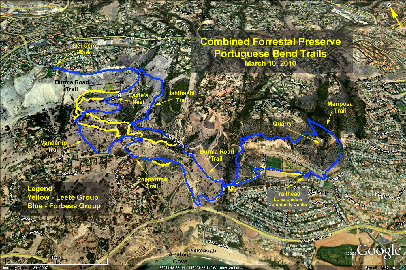
Forrestal & Portuguese Bend Trails Map
Google Earth Photo - Forrestal & Portuguese Bend Reserves
GPS Elevation Data:
Trailhead Elevation = 450 ft.
Yellow Trace: Trailhead to Eagle's Nest and return.
Peak elev. = 961 ft. (Eagle's Nest).
Min elev. = 171 ft.
Max delta = 790 ft.
Blue Trace: Trailhead up and over quarry, then ultimately out to del Cero park and return.
Peak elev. (del Cero Park) = 1187 ft.
Min elev. = 165 ft.
Max delta = 1022 ft.
Cumulative elevation = 2200 ft. total gain.