GPS Data:
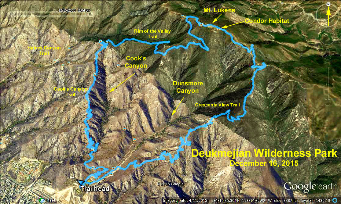
Hike 1: RT Distance: 5 mi.
Max. Elevation Change: 1183 ft.
Hike 2: RT Distance Loop: 10 mi.
Max. Elevation Change: 2746 ft.
Cum. Elevation Gain: 2900 ft.
Trailhead Directions: For GPS purposes, the Park is above 3429 Markridge Road, La Crescenta 91214.
From the 210 Freeway, exit at Pennsylvania Ave. and head north to Foothill Blvd. Left on Foothill, and right on New York Ave. Continue north on New York until it dead ends at Markridge. Turn left and then the next right into the park. Drive north and park in any of the lots near the top of the hill. Parking is free. There are restrooms at the park.
Hike 1 will ascend clockwise through Cooks Canyon passing over a stream and several footbridges to the Rim of the Valley Trail, continuing to the Haines Canyon fire road and back.
Hike 2 will continue onward for 3 more miles to the top of Mt. Lukens (5,074 ft.), the highest point in Los Angeles. After a stop at the top, head east to loop down to the trailhead via the Crescenta View trail.
Google Map - Deukmejian Wilderness Park