Hike #1254
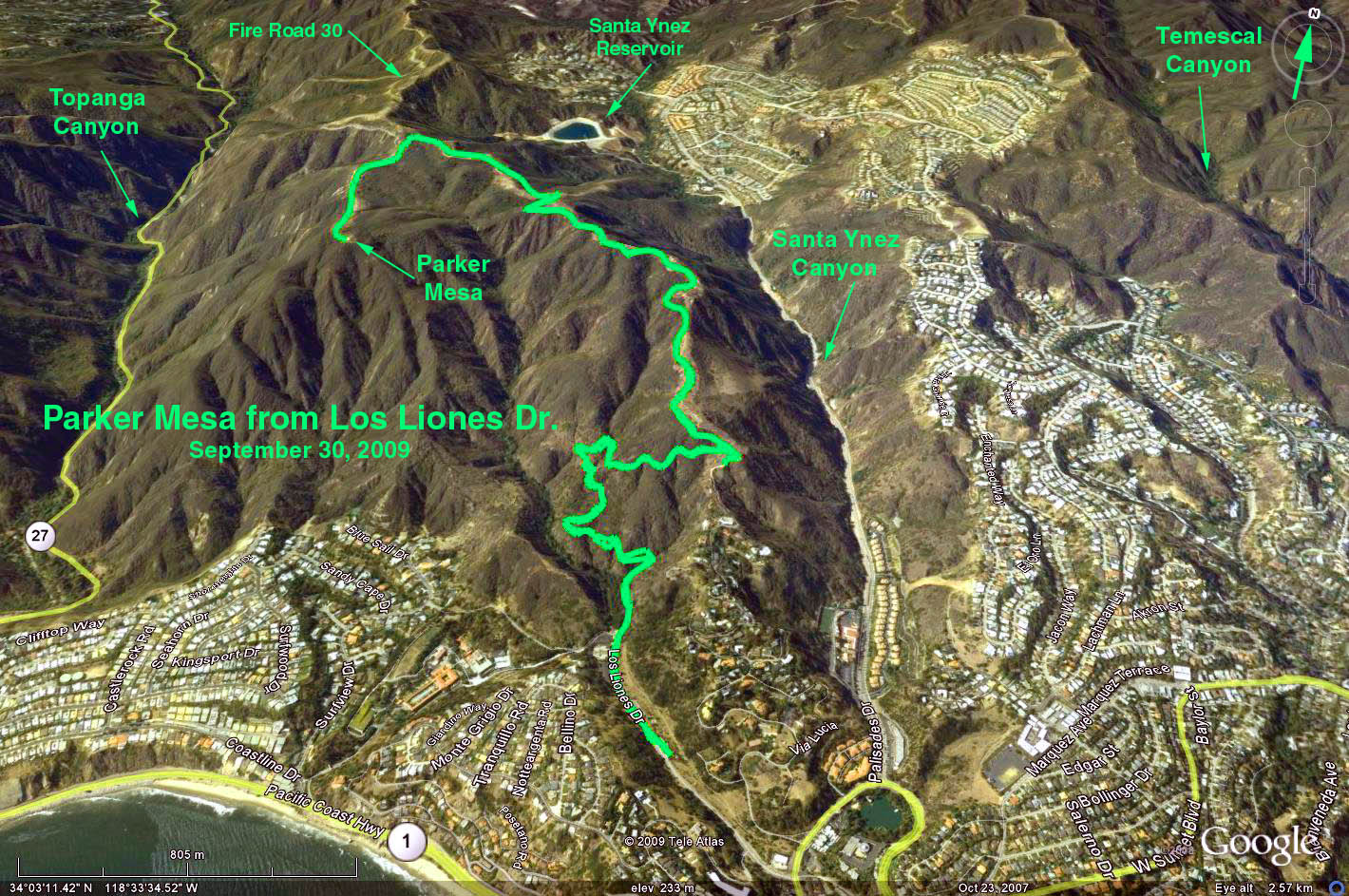
Parker Mesa from Los Liones Trailhead
December 9, 2015
Jim Hartung, Hike Leader
GPS Data:
Distance: 7.4 mi. RT
Max Elevation Change = 1250 ft.
Shorter and longer hikes are available.
Summary: This hike climbs the Los Liones Trail in Topanga State Park, from Pacific Palisades to two viewpoints overlooking Santa Monica, Palos Verdes and Catalina Island. The first viewpoint is 1.5 miles from the trailhead and the second viewpoint is 3.5 miles from the trailhead. Those who want a longer hike may continue past the second viewpoint.
Directions to Trailhead: From the valley: Take Topanga Canyon Road to PCH, and then drive south to Sunset Blvd. Go east on Sunset for 0.3 miles (to the second signal) and turn left on Los Liones Drive. Go north on Los Liones Drive for 0.3 miles and park in the first parking lot. If you pass the first parking lot, you will come to a another parking lot 0.1 mile further up the road. You may park in this lot if the first lot is full. If you reach the dead end of Los Liones Drive, you have gone too far so turn around and drive back to the parking lot. From the south: Take PCH to Sunset Blvd. and follow instructions above.
There are bathrooms and picnic tables at the trailhead. Refreshments will be served there.
The Hike: This hike climbs the Los Liones Trail for 1.5 miles and 530 feet of elevation gain to a ridge-top clearing that looks down on Pacific Palisades, Santa Monica, and the ocean beyond. On a clear day, the view extends to Palos Verdes and Catalina Island. Those who want a short hike may turn around here for a 3 mile RT hike.
Those who want a longer hike can continue along the Topanga fire road to the Parker Mesa Overlook, which is 3.5 miles from the trailhead with a total of 1250 feet elevation gain. The view here is spectacular, similar to the first one, but from a higher elevation. Those eager for more exercise may continue along the Topanga fire road before returning to base camp.