Hike #1252
Tapia Park to Malibu Creek State Park
November 18, 2015
Anna Decker, Hike Leader
GPS Data:
RT = 3.7 mi
Max. Elevation Change = 275 ft.
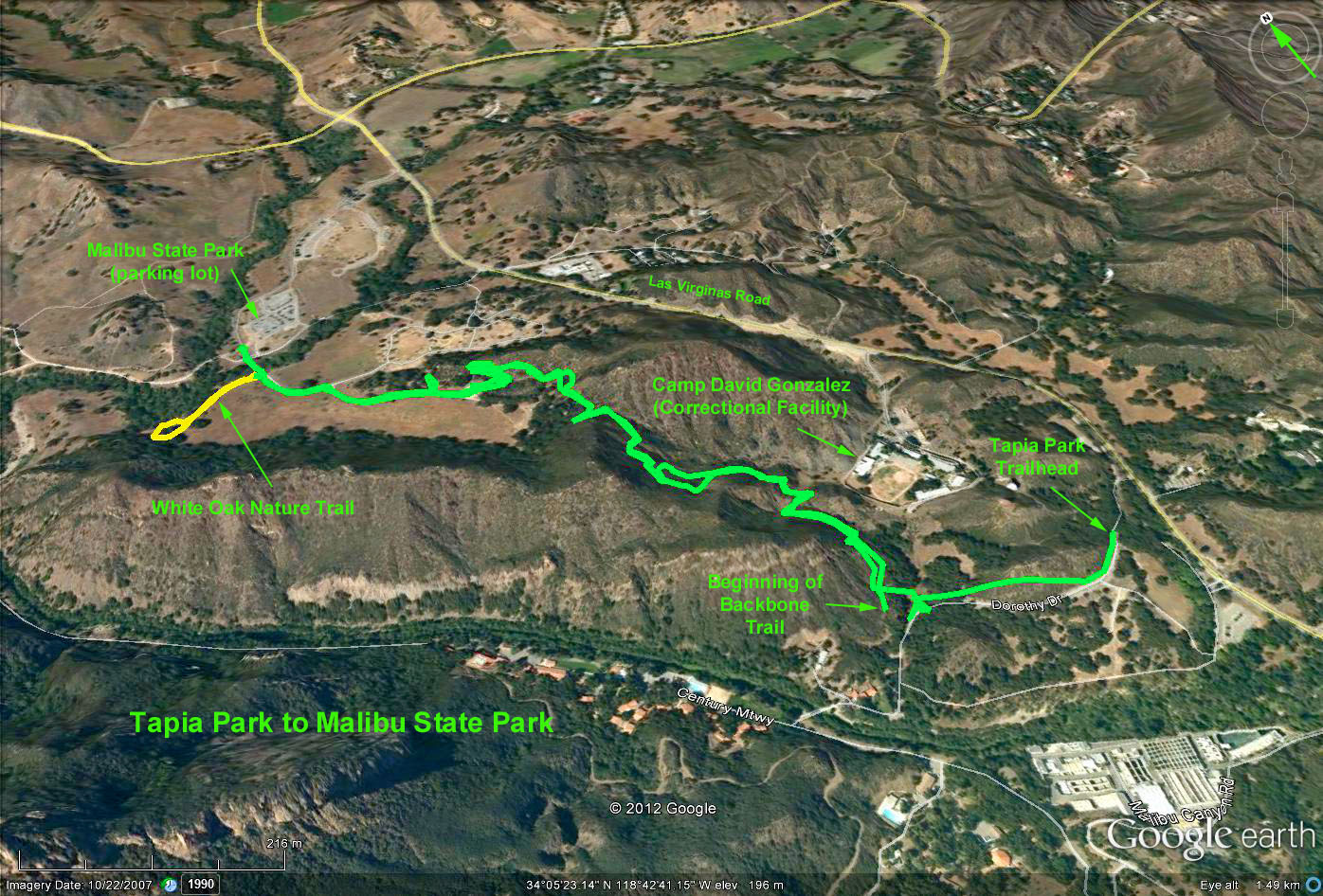
Direction to Trailhead: From PCH, go north on Las Virgenes (Malibu Canyon Road). After passing Piuma Road, make a left turn into Tapia Park and park. From the 101, go south on Las Virgines Road. Just before Piuma Road, turn right into the park, and park. Restrooms available at parking area and at both parks. This is a State Park with an entrance fee of $11 for Seniors
The Hike: From trailhead proceed north on the Backbone Trail. Stay on path until we come to a parking lot in Malibu Creek State Park. Just before the parking lot and wood fence make a right at the trail marker and water faucet. This trail goes between the gravel road and the oak trees & then winds up a small hill. Make a left up to the top of the knoll. Follow the trail down, (short, but steep) back to the gravel road. Take the trail on the left side of the gravel road (marked by a 15 mph sign) for about 300 yards. Turn left at the hike sign and picnic table. For those in need of a restroom continue down the gravel road for about 100 yards). Path at picnic table is a small nature trail. Return to the trailhead in Tapia Park.
Many options exist for those wanting a longer hike. From here you can either hike to the south end of the dam in Malibu Creek and return or hike around Tapia Park. Some may be venturous enough to continue to follow the Backbone Trail south to a stopping place of their choosing.