Hike #1248
Backbone Trail - East from Kanan Dume Road
October 21, 2015
Shirley Feinblatt, Hike Leader
GPS Data:
RT Distance (to Obert Peak) = 8.4 mi.
Max Elevation change = 510 ft.
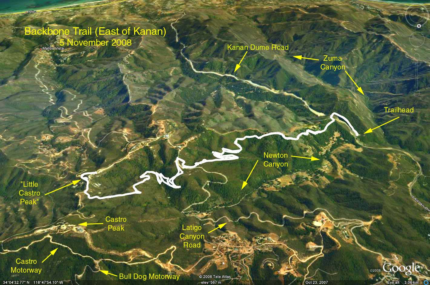
Directions to Trailhead: From PCH, go north on Kanan Dume Road until you go through the tunnel, park in the parking area on the left side of the road.
From the 101, take Kanan Dume Road south. Proceed through tunnels T3 and T2. As you approach tunnel T1, youll see the parking area on the right. If you go through tunnel T1, youve gone too far. There are no restrooms at the trailhead.
The Hike: Take the trail that parallels Kanan Dume Road south up to the ridge on top of the tunnel, then turn east, 2.3 miles to Latigo Canyon Road. Cross Latigo Canyon Road to a large parking area. The trail continues across this area on the left. Proceed 1.4 miles from Latigo Canyon to a fire road to leading to a saddle at which point turn left and hike up to the locked gate blocking further access to Castro Peak. Do not attempt to go any further!
After back-tracking to the saddle, continue across the saddle on the fire road leading up to a lesser peak opposite Castro ("Little Castro Peak" - known among OTP'ers as Obert Peak). At the top, side-track to the right up a mound to the peak and a wonderful overview. This is a good place to eat lunch.
Return to the trailhead the way you came. An alternate return path is to continue on down the fire road that got you to Obert peak until you reach Latigo Canyon Road. Turn right and walk the road until you come to the place where you crossed the road on the way to the peak. Turn left and return.
Refreshments served at the trailhead.
Google Earth photo - Backbone Trail - East from Kanan Trailhead. (NOTE: Photo vantage point is north looking south).