Hike #1246
Red Box to Strawberry Peak/Springs
October 7, 2015
Pat Forbess, Hike Leader
GPS Data:
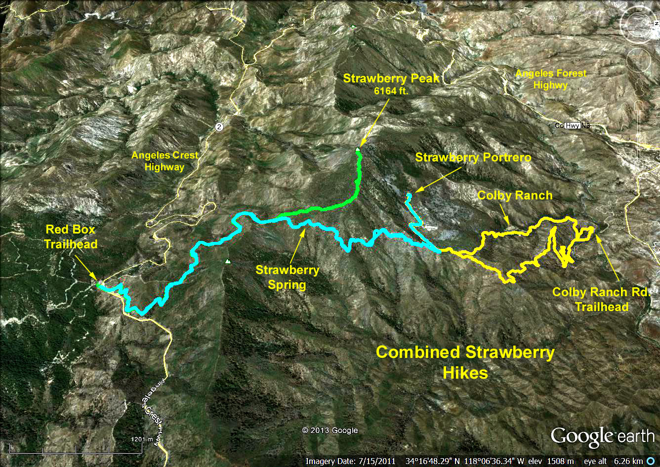
Redbox to the peak = 7.1 mi.; Max Elevation change = 1510 ft.
Redbox to the spring = 6.8 mi.; Max Elevation change = 610 ft.
Trailhead Directions: Meet at Red Box Station at mileage paddle 38.38 on the Angeles Crest Highway (about 14 miles from I-210 at the Mt. Wilson road turn off). There are restrooms at Red Box.
Features: Strawberry Peak's 6164 foot summit beats San Gabriel Peak's 6161 foot to claim the honor of being the highest peak in the Front Range. Although its profile appears rounded as seen from most places, its flanks fall away sharply on three sides, leaving only one relatively easy route to the top (our route).
The Hike: From Red Box we cross the highway and walk east along the left shoulder of Angeles Crest Highway to a fireroad slanting left up the hillside. We continue up the eroded bed of the road for 0.6 miles to reach a trail on the left. From there the trail switchbacks up to a saddle due south of Mount Lawlor's summit, and from there on uphill to the saddle on the northwest shoulder of Mount Lawlor. At this point we have climbed almost 600 ft. and hiked approximately 2.3 miles.
Those who want to climb the peak take off on a trail to the left and climb approximately 900 ft. over the steep and rocky 1 mile route to the peak.
Those who want to go to Strawberry Springs continue on the same trail we used to get to the Saddle for approx. 1 mile. The trail drops down approximately 400 feet from the saddle to the spring.
Refreshments will be served at Red Box.