Hike #1234
July 15, 2015
Forrestal Reserve/Portuguese Bend Reserve
GPS Data:
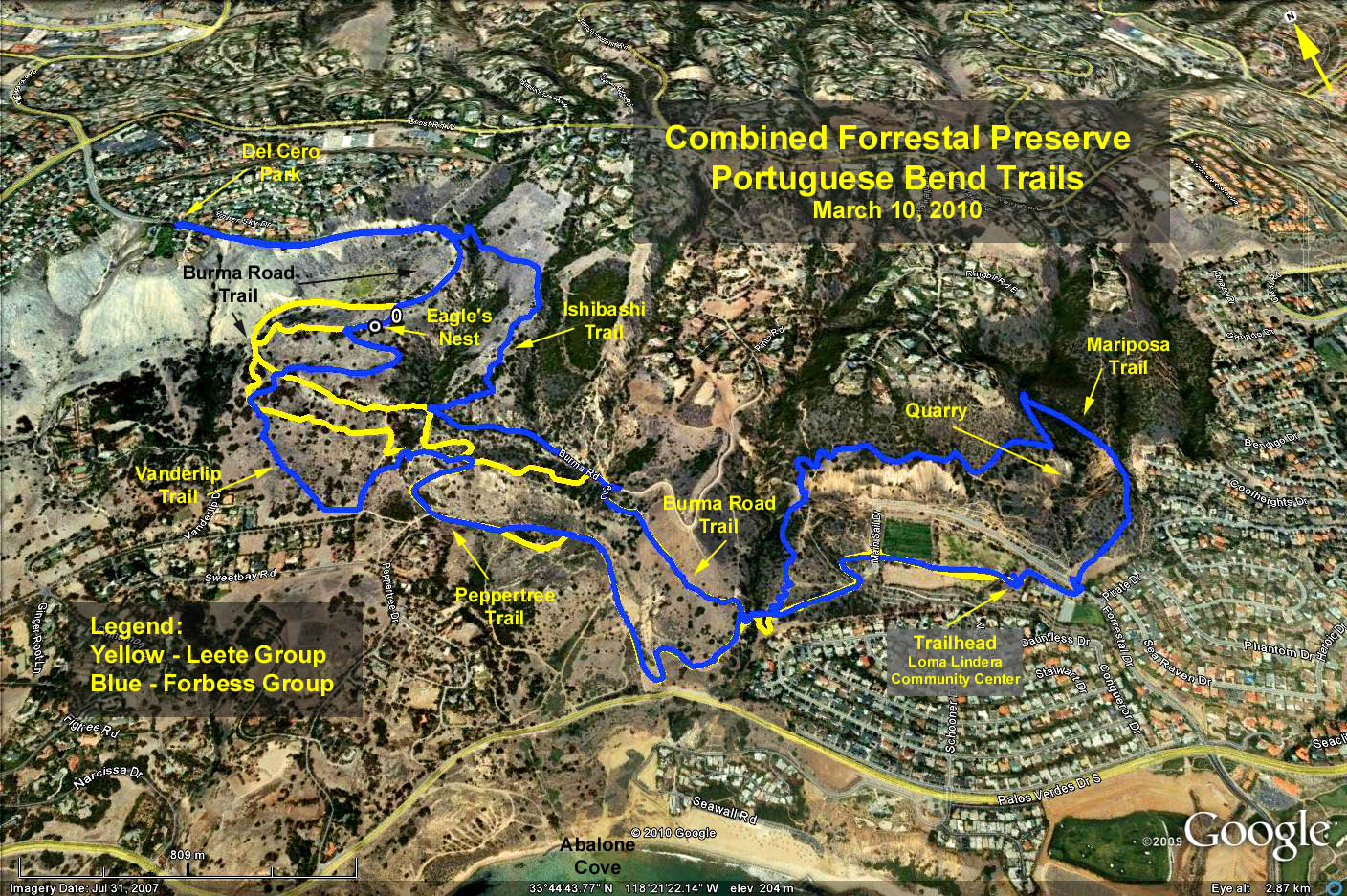
Google Earth Photo - Forrestal & Portuguese Bend Reserves
Yellow Trace: Trailhead to Eagles Nest and return = 5 mi RT.
Peak elev. = 961 ft. (Eagle's Nest).
Min elev. = 171 ft.
Max delta = 790 ft.
Blue Trace: Trailhead up and over quarry, then ultimately out to del Cero park and return = 7.7 mi RT
Peak elev. (del Cero Park) = 1187 ft.
Min elev. = 165 ft.
Max delta = 1022 ft.
Cumulative elevation = 2200 ft. total gain.
Directions to trailhead: Go south on Harbor Freeway (110). Exit (left) to Gaffey. Continue south to 25th. Turn right on 25th. Go approximately 3.4 miles to Forrestal Drive. Turn right to Ladera Linda Community Center. Go through parking lot and following road to Additional Parking area. You will be passing the Ladera Linda Community Center where the bathrooms are located.
Alternate: Go south on Hawthorne Blvd. to Palos Verdes Drive South. Turn left on Palos Verdes Drive South, pass Portuguese Bend and turn left on Forrestal Drive. See above for additional parking instructions.
Hike alternatives:
Easy (about 4.0 miles): Continue through parking lot, up first set of stairs. Take driveway to left of second set of stairs. Cross Intrepid Drive and start the hike at the Purple Sage trailhead. Continue to Conqueror trail. Take path to left to avoid steep and also slippery loose gravel part. Take the stone bridge and stay on lower path. Turn right on Klondike Canyon Trail, then Panorama Trail (can also be reached by turning right on the Barn Owl Trail). When you reach the Sandbox Trail, veer left to the Peppertree Trail. Turn right until you reach the Toyon Trail. Once you reach Burma Road Trail turn right and right again on Panorama Trail to Klondike Canyon Trail and from there return to parking lot the way you came.
Moderate (about 6 miles) Follow instructions to Peppertree Trail as for the Easy Hike. From there take Garden Trail (rather than Toyon Trail) past water tank and veer left on Water Tank Trail, right on Vanderlip Trail, right on Kubota Trail. When you reach the Water Tank Trail again, turn left and go to Burma Road Trail. Once you reach Burma Road Trail, turn right and again right on Panorama Trail to Klondike Canyon Trail and from there return to parking lot the way you came.
Difficult (about 8 miles). From reserve entrance on Forestal Drive, take these trails: Pirate Trail, Mariposa Trail, Flying Mane Trail, Canyon Trail, Dauntless Trail and turn right on Conqueror Trail. For an additional adventure, you could go on the Vista Trail to the Vista Point and then return to Dauntless Trail. From Conqueror Trail continue as outlined for either of the hikes above. When you reach Burma Road Trail, turn left and go to Del Cero Park and return from there to the Parking lot.
Note: Maps will be available on hiking day. You may also want to download them beforehand from the Palos Verdes Land Conservancy web site which provides also other interesting info.