Hike 1230
June 17, 2015
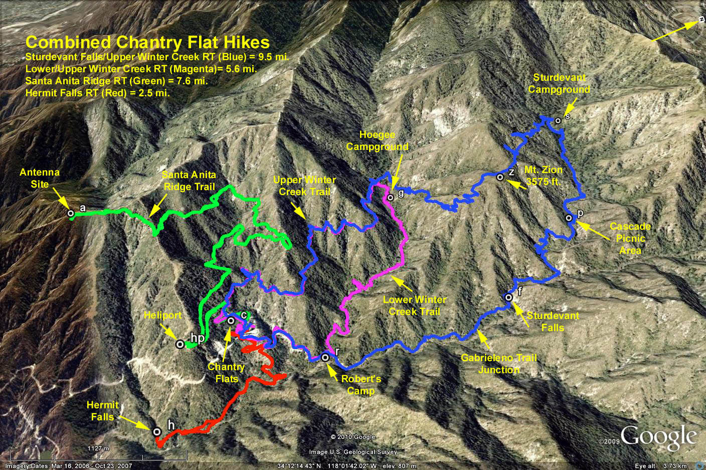
Winter Creek Loop
Wendell Suzuki, Hike Leader
Directions to trail head: From the 210 Freeway, exit on Santa Anita Ave north and drive approx. 6 miles to the Chantry Flat Recreation Area parking lot. Restrooms are available. National Forest parking pass is required.
The Hike: Follow the paved road below the parking lot into Santa Anita Canyon (0.7 mi), across a bridge and bear left on the marked Lower Winter Trail. If you want a short 6 mile follow the signs to Hoegee Camp and take the Upper Winter Creek Trail that ends at the picnic grounds at Chantry Flat. Elevation change is approx. 1000 ft.
If you want a longer hike (9.5 mi) continue on the Gabrielino Trail to Sturtevant Camp and return via the Zion and Upper Winter Creek Trails. Elevation change is approx. 2100 ft. Refreshments will be served at the picnic grounds.