Hike #1228
June 3, 2015
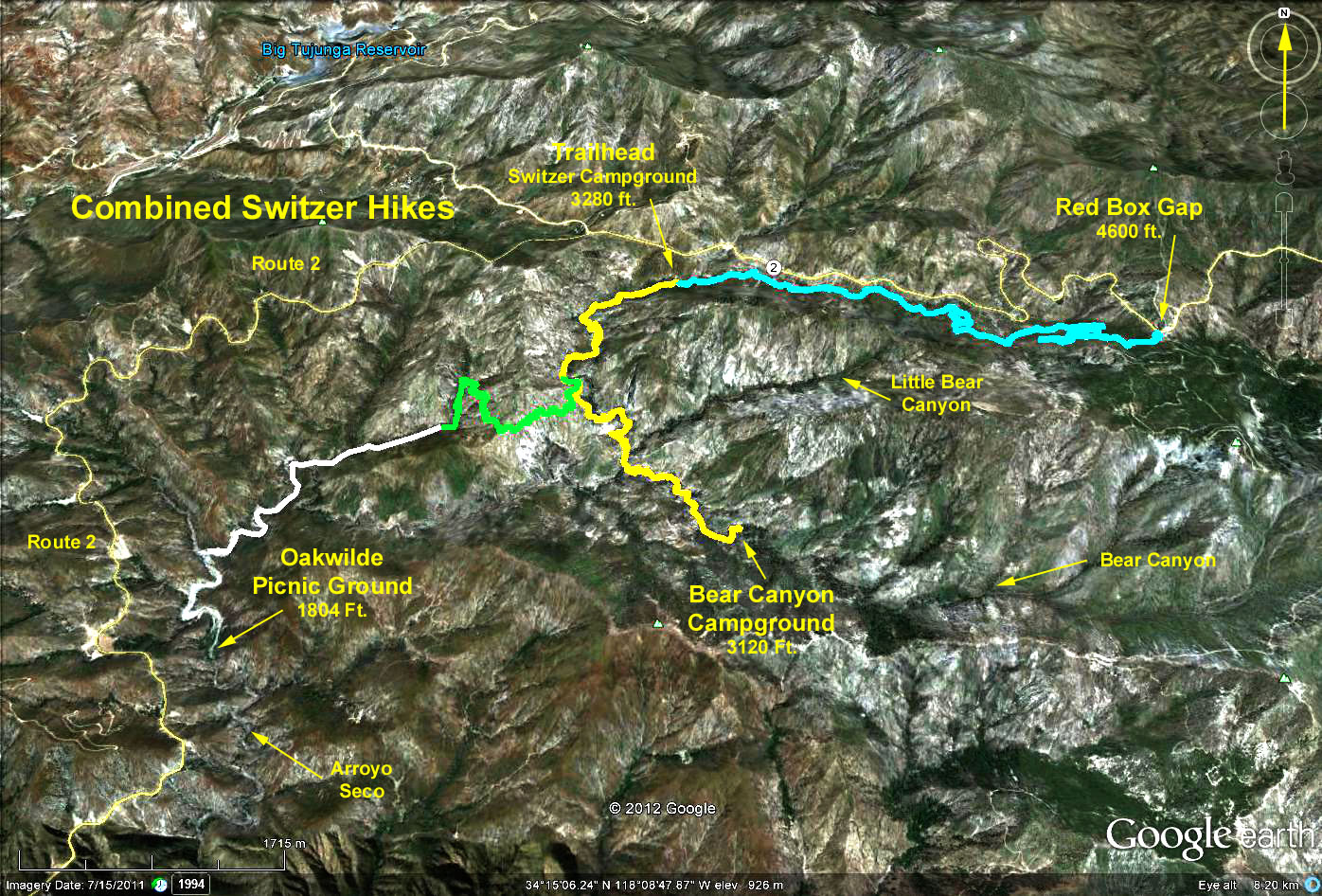
Switzer to Red Box, Bear Canyon or Oakwilde Campground
John Nakagawa, Hike Leader
Three hike destinations are available from this trailhead: Red Box, Bear Canyon, and Oakwilde Campground.
Directions to Trailhead: Drive up the Angeles Crest Highway from La Canada for 10 miles. About 0.4 miles after passing Clear Creek junction, look for the turnoff to Switzers on the right (paddle 34.19). Drive down to the Switzer Picnic Area parking lot and park. There are toilets in the picnic area.
Bear Canyon Option: After crossing the bridge, follow the trail down the canyon, boulder bounding where necessary. After a mile, the ruins of Commodore Switzer's Camp are reached, at which point we cross the stream and continue up hill as we climb up and over the west slope above the falls. At one point, the falls come into view nestled in the rock face far below us. After we reach the top of our climb, we head left at a junction of two trails, one to Bear Canyon (left), and one to Oakwilde Campground (right). We continue, descending into the Bear Canyon gorge.
Upon reaching the creek, we head downstream past a series of cascades and pools - certainly the most beautiful and peaceful trek in all the San Gabriels. Along the way, we pass the junction of the Arroyo Seco and Bear Creek, noting the change in direction of water flow. Eventually, we come to a slight incline leading up out of the stream bed to Bear Canyon Campground. There are picnic tables and toilets in the campground. GPS Data: RT = 7.5 mi.; Max Elevation change = 960 ft.
Red Box Option: Go beyond the eastern end of the parking lot picking up a trail that traverses the canyon leading up to the west slope of Red Box Gap. (Angeles Crest Hwy., running from Clear Creek junction to Red Box, is built along the north slope of this canyon). Lunch will be at Red Box then return by the same trail. The trail is fully shaded with many scenic views. GPS Data: RT = 8.7 mi.; Max Elevation change = 1300 ft.Oakwilde Campground Option: Follow the Bear Canyon Option instructions except turn right at the trail junction. This trail is currently closed due to multiple washouts, damage caused by the Station Fire.
Refreshments in the Switzer picnic area.