Hike 1227
May 27, 2015
Temescal Canyon, Skull Rock & Beyond
Anneliese Grohs, Hike Leader
GPS Data:
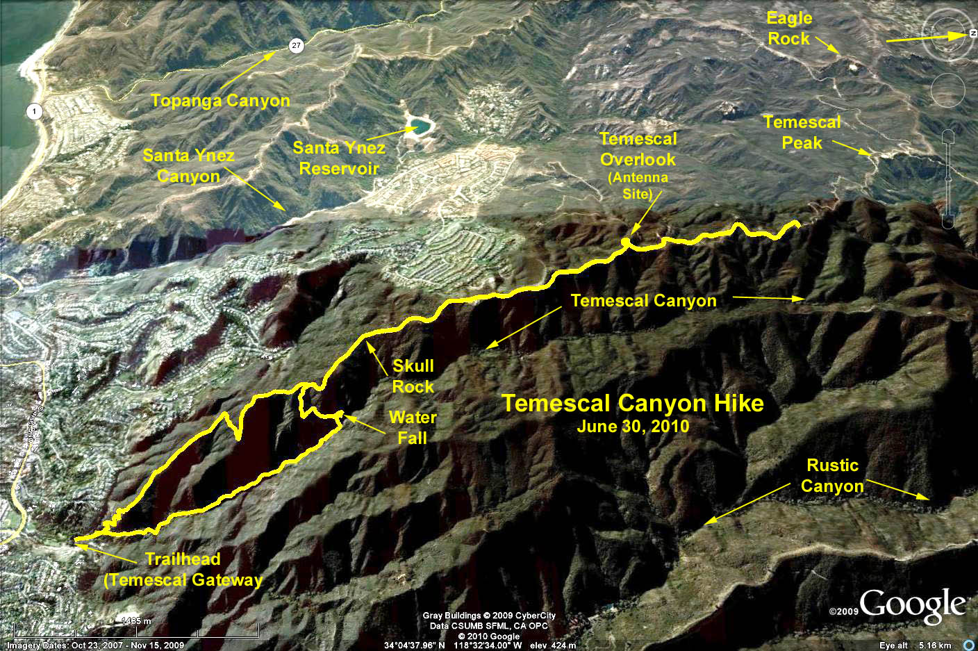
One way to Skull Rock: 2.3 mi. via the canyon trail and 2.2 mi. via the ridge trail. Max elevation change = 1120 ft.
One way to the Antenna Site: 3.6 mi. via the canyon trail and 3.3 via the ridge trail. Max elevation change = 1600 ft.
"Extra miles" hike, halfway to Temescal Peak (shown in the photo) = 9.1 miles RT, with an elevation accumulation = 2040 ft.
Directions to trail head:
a) From Los Angeles head west on the Santa Monica Freeway (I-10) to its end and continue north on Pacific Coast Highway. Turn north (right) on Temescal Canyon Road and drive 1.1 miles, cross Sunset Blvd. and into Temescal Gateway Park.
b) Going south on Pacific Coast Highway, turn east (left) on Sunset Blvd., and continue through Pacific Palisades to Temescal Canyon Road, turn left (north) into the parking area.
c) From 405 Fwy. go west on Sunset Blvd. to Pacific Palisades and turn right into Temescal Gateway Park.
The parking fee is now $7. Street parking along Temescal Canyon Rd. is a possibility if you don't mind walking a few hundred yards up and across Sunset Blvd. Parking on Sunset is limited to two hours.
And please be aware of the stop signs around the parking area; they have cameras, so come to a full stop. (the fine was $175).
Restrooms are in two locations: the lower parking lot and near the campus store.
The hike: Walk up the canyon on the landscaped path past the restrooms. The footpath soon crosses a branch of Temescal Creek. Continue through the canyon. The path ascends moderately to another footbridge and a close-up view of a small waterfall. The path steepens and climbs westward up Temescal Ridge to a signed junction with Temescal Ridge Trail. Continue uphill a half-mile to Skull Rock. Some might want to turn around here, the others can continue on to the Antenna Site, Temescal Peak and even Eagle Peak via Fire Road 30. Return is either retracing your steps through the canyon, or else via the Ridge Trail to the parking lot.
Google Earth Photo - Temescal Canyon to Skull Rock and Beyond
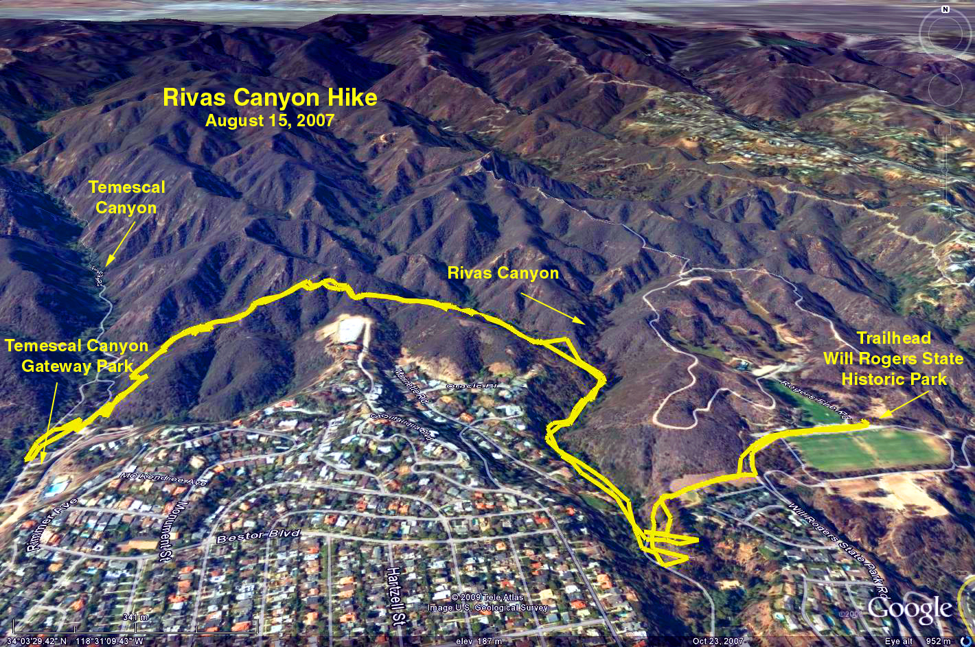
Another hike option is to Will Rogers State Park and back via the Rivas Canyon Trail = 4.2 miles RT, elevation gain/loss: 910 ft. maps are available near the upper parking lot.
Google Earth photo - Rivas Canyon Trail