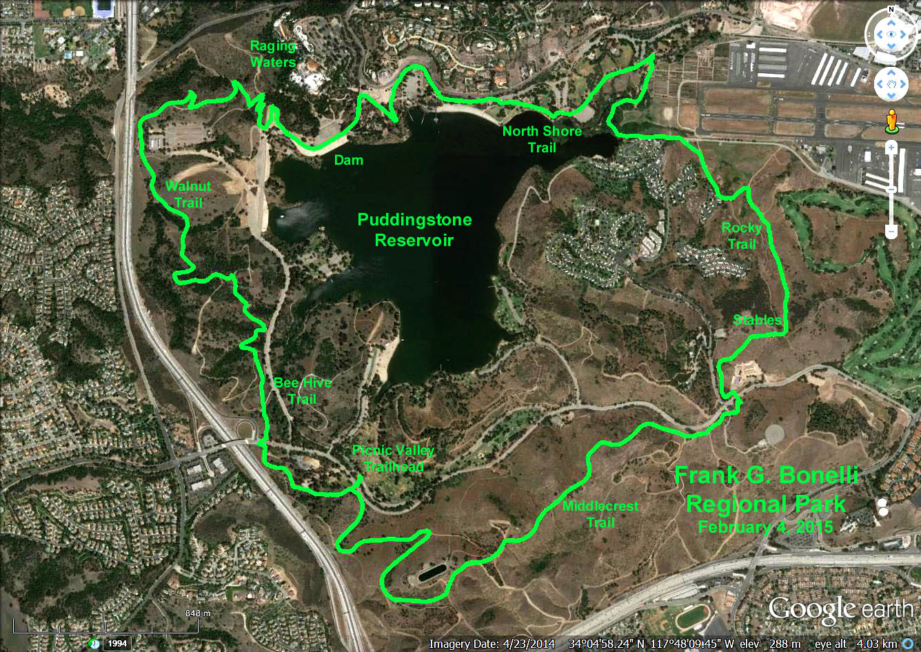
There are many trail options: Around Puddingstone Reservoir, approx. 5 miles.
Around the outer loop, GPS Data: 8.1 miles. Max elevation change 400 ft.
Directions to the Trailhead: Bonelli Regional Park is located at 120 East Via Verde in San Dimas. From Orange County take the 57 north, exit Via Verde and head east. West Valley take the 210 east to the 57 south, exit Via Verde and head east. South Bay make your way to the 605 north to the 10 east to the 57 north, exit Via Verde and head east. Drive straight past the entrance booth (admission is free on weekdays during the winter!) and park in the lot to the left next to a large picnic area. Restrooms are available near the parking lot and throughout the park.
The Hike: Bonelli Park is interlaced with big wide equestrian trails as well as paved pedestrian paths so many options are available both long and short - see trail map at the link below.
The recommended route is a counter-clockwise loop around the park perimeter using the Middlecrest Trail to the stables, Rocky Trail around the airfield, North Shore Trail to Raging Waters, Walnut and Bee Hive Trails back to the Picnic Valley Area where refreshments will be served.