GPS Data:
RT = 6.6 mi.
Elevation gain = 1400 ft.
Hike Overview: Because of limited parking, this is a modified shuttle hike.We will meet at Leo Carillo State Beach at 0900. We will then shuttle hikers to the trail head leaving 4 or 5 cars there depending on how many hikers choose to make the loop hike as described below.
Directions to Trailhead: The meeting place is at Leo Carrillo State Beach which is about 10 miles west of Malibu Canyon Road on the PCH. There is a charge for parking and there are restrooms nearby.
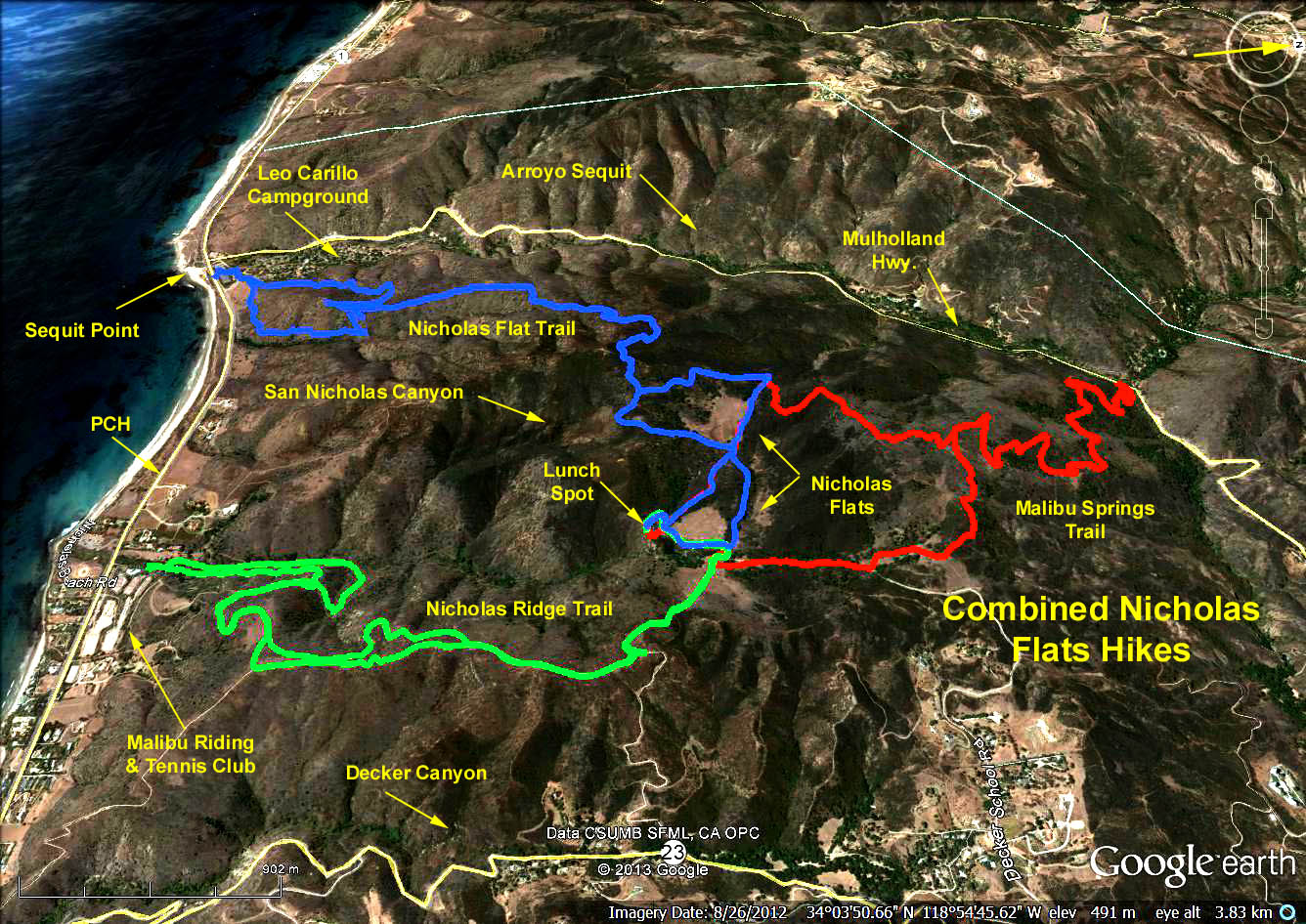
The Loop Hike: The hike on Malibu Springs Trail starts from Mulholland Highway at about 400 ft. elevation and climbs to 1840 ft. and then drops about 200 ft. to Nicholas Flat and then another 200 ft. to the pond and lunch spot. To follow this route, take the right fork where there is a sign indicating the park boundary. When you arirve at the Flat there will be another sign at the junction with the Nicholas Flat Trail. Go left. If you continue sraight you will return to Leo Carrillo. A mile or so brings you to the pond.
To return, leave the pond area via a trail in the process of being improved so that it can accomodate wheel chairs. When this trail reaches Decker School Road, there is a gate to the left. Go that way. The trail is rather vague but it shortly meets a well defined trail, go left. This returns you the the junction where the park boundary sign was. Its all down hill from here.
Alternate Return: Upon leaving the pond, work your way to the left (westerly) on trails skirting the ridge opting for left turns at two upcoming trail intersections. This should put you on the Nicholas Flat Trail which descends into the Leo Carillo Campground where refreshments will be served.