Distance: 6 miles RT
Max Elevation Change: 750 feet total gain
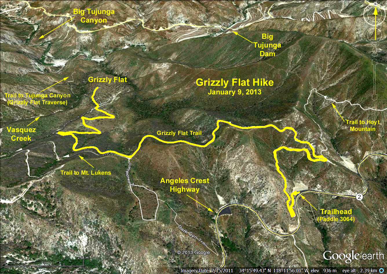
Trailhead Directions: From the 210 Freeway drive north on Angeles Crest Hwy. (Route 2) 6.2 miles to a parking area on the left (north) side of the road - mileage paddle 30.64.
The Hike: Climb some 600 ft. in the first mile, then ascend an easy 100 ft. to a saddle. Cross the saddle and descend 680 ft. to Grizzly Flats. Along the way we will have an excellent view of Tujunga Canyon as we descend the escape route used by Tiburcio Vasquez in his early raids on the ranchers of Los Angeles. Return the same way.
Grizzly Flat sits on the crest of the divide between the Arroyo Seco and Big Tujunga watersheds amid a grove of pines planted by the Forest Service after a fire in 1958. A faint, unmarked trail goes off to the right to Vasquez Creek in about 1/4 mile. There is no trail along Vasquez Creek but you can follow the creek a short distance in either direction.
Caution: When this trail was hiked in January 2009 there were numerous obstructions on the trail resulting from the August 2009 Station Fire in the San Gabriel Mountains. The trail down from the saddle got worse as we got lower, climbing over, around and under many downed and burned trees.
Google Earth Photo - Grizzly Flat Hike
GPS Data:
RT = 6.0 miles
Max Elevation Change = 740 ft.