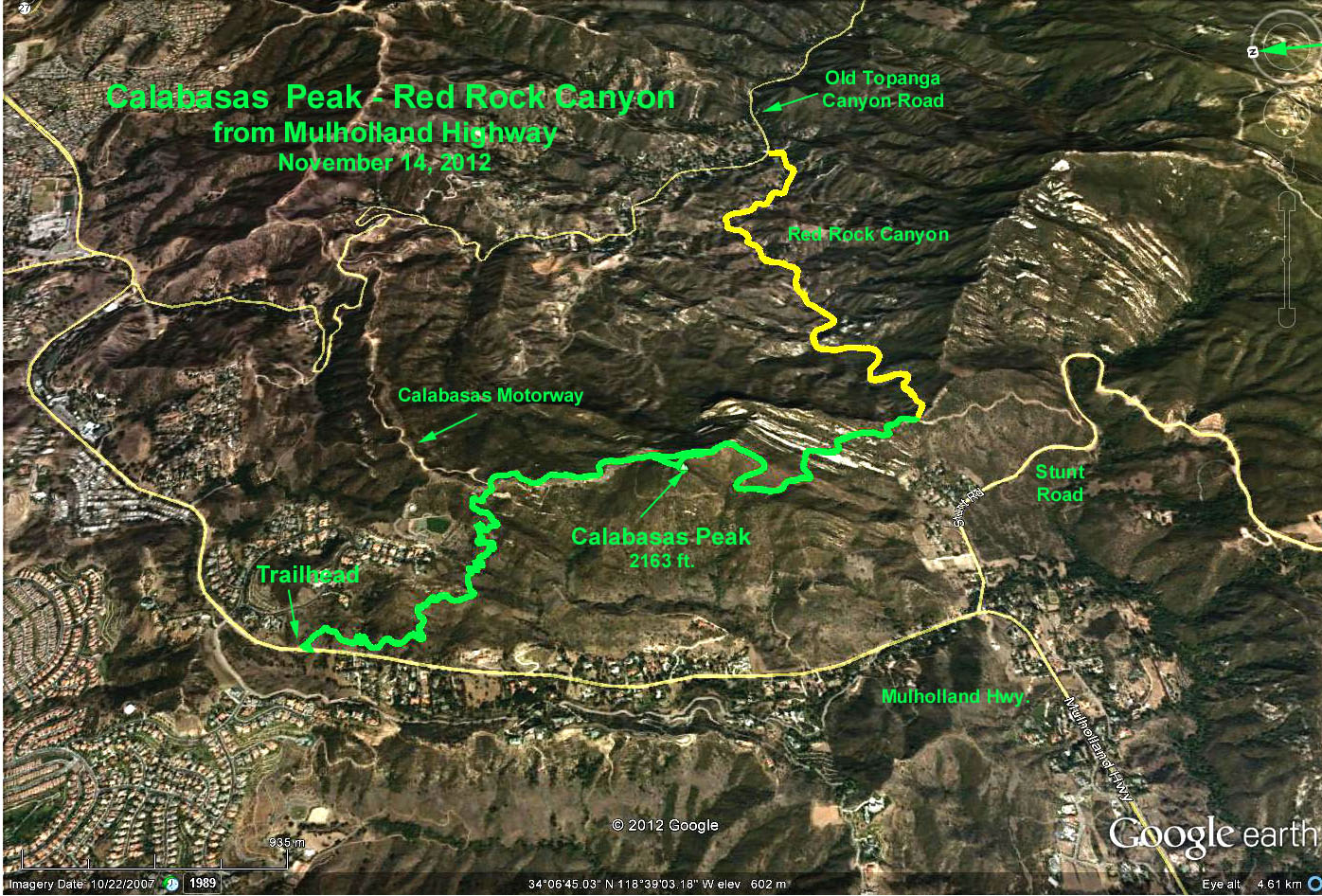
Basic Hike: 7 mi. RT, max. elevation change = 1700 ft
Red Rock Extension: 4 mi. RT, max. elevation change = -560 ft.
Directions to Trailhead: Head west on the 101. Leave the freeway at the Valley Circle Blvd. / Mulholland Dr. exit. Turn left onto Mulholland Dr. and cross over the freeway. Continue for 0.6 miles and turn right on Valmar Rd. After 0.4 miles, Valmar Rd. turns into Old Topanga Canyon Rd. After 0.75 miles, turn right on Mulholland Hwy. Do NOT continue left on Old Topanga Canyon Rd. Stay on Mulholland. After 1.9 miles you reach the intersection of Dry Canyon Cold Creek Rd., gated Mountain Park Dr. and Mulholland Hwy. The trailhead is located on the left, 0.2 miles past this intersection, on Mulholland. The trailhead has a Santa Monica Mountains Conservancy Parkland sign. The trailhead is also 5.7 miles east from the intersection of Las Virgenes Rd. and Mulholland Hwy. There are no restrooms at the trailhead.
Basic Hike: The trail climbs steadily soon a preliminary ridge. After a small dip, the trail ascends the main ridge, at which point it meets the dirt Calabasas Peak Motorway at 1.4 miles. Proceed south on the Motorway and continue about 150 yards beyond the obvious high point that is Calabasas Peak, and look, on your right for the use trail to the peak, which rises only 100 feet above the motorway. Continuing a mile southward, and mainly down on Calabasas Peak Motorway, will get you to the junction with Red Rock Road. Return the way you came.
Red Rock Canyon Option: Continue on Red Rock Road as far as you wish. Return the way you came.
Google Earth Photo - Calabasas Peak - Red Rock Canyon from Mulholland
Updated: 2021-04-20