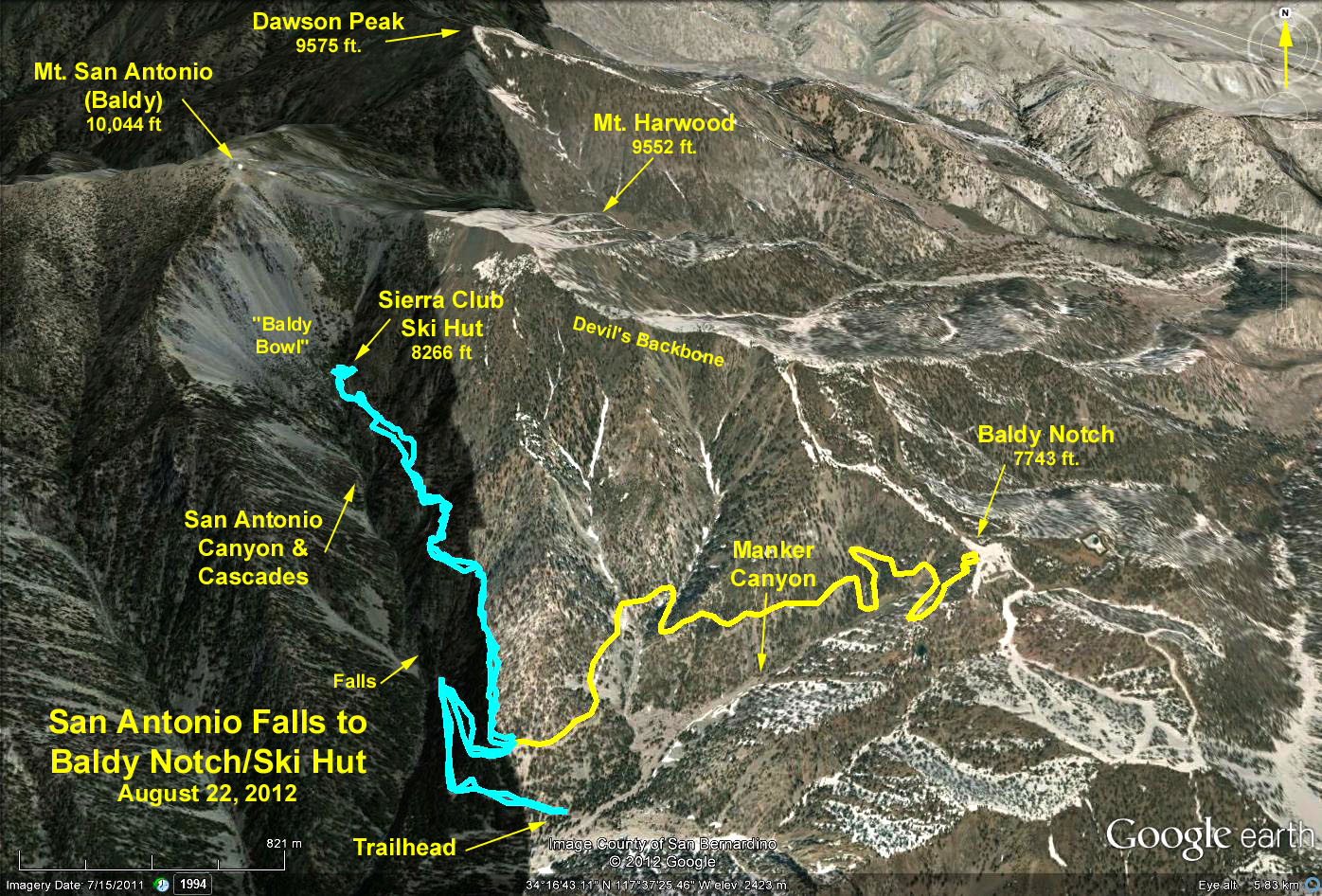
Distance to the notch = 7.4 mi. RT and 1600 ft. max. elevation change.
Distance to the ski hut = 5.5 mi. RT and 2000 ft. max. elevation change.
Directions to Trailhead: 210 Freeway; exit to Baseline Rd. Turn left on Baseline Rd for one block and turn right on Padua Avenue. In 1.7 miles turn right on Baldy Road. Continue up Baldy Road almost to the end and park at the San Antonio Falls turnoff.
The Hike to the Notch: Hike past the locked gate up the San Antonio Falls Road. The road is paved for about .6 miles to the falls. At the falls the road makes a sharp right and becomes a dirt road the rest of the way to the notch. At about 7600 ft elevation, near the notch there is a Y. Take the left fork to the restaurant. From the Restaurant walk a few hundred yards east up a dirt road to Desert View. Return the same way.
The Hike to the Ski Hut: Start out as above. From the falls walk .3 miles up the dirt road to a trail on the left marked Baldy Trail (new sign) that leads to the San Antonio Ski Hut. The trail goes up the canyon paralleling the falls cascade. It is well shaded, steep in places, and requires climbing some rocks along the way. There are benches and a few tables and a pit toilet in the vicinity of the hut. Return the way you came.
Thunder Mountain Option: From Desert View follow the fire road southeast up Gold Ridge to Thunder Mountain. 10 mi. RT and 3000 ft.
Google Earth Photo - San Antonio Canyon/Baldy Notch
GPS Data:
Baldy Notch: 6.1 mi. RT and 1526 ft. max elevation.
Ski Hut: 5 mi RT and 2005 ft.max elevation.