Distance to the Mine: 4 miles RT and max. elevation change = 500 ft.
Distance to the trail camp = 6 mi. RT and max. elevation change = 2000 ft.
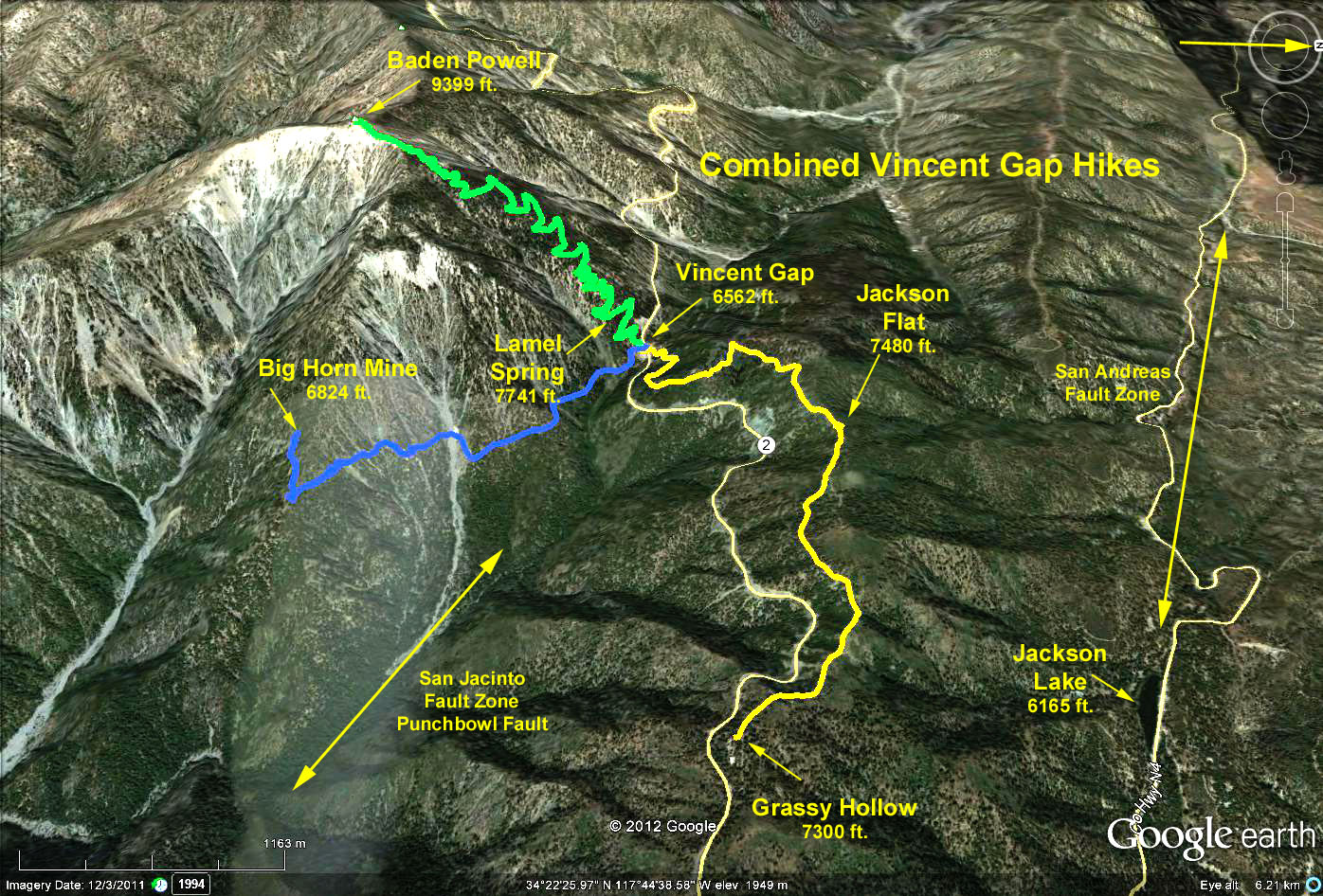
Directions to Trailhead: The trailhead is located at Vincent Gap on the south side of Angeles Crest Highway (Route 2) at paddle 74.80, about 50.4 miles (1 hr 20 min) up from the 210 freeway in La Canada. There is a restroom located at the parking lot.
The Hike to the Mine: The trail begins on a dirt road that starts going south beyond the trailhead up to Baden Powell. After about 100 yards, the trail down into Vincent Gulch appears off to the left - continue straight ahead. About half way, you pass a washout (part of the head waters of the East Fork of the San Gabriel River). Just past the washout you pass a small mine tunnel with water flowing out. The trail continues up and over a ridge topping the massive butress of Baden Powell where the deep gorge of the East Fork of the San Gabriel River and its tributary canyons come into view. Beyond looms the grayish mass of Old Baldy.
Past the ridge, the foundations of the mine are encountered then round a bend, the old stamping mill comes into view. At this point the trail ends. Continuing further is discouraged by posted "No Trespassing Signs" and rather dangerous slopes. Up to the right of the trail are two vent openings with a strong flow of cool air - just right to cool the hiker on a hot day. Return the way you came.
The Hike to the Campground: Start out as above except turn left and take the trail descending into the gulch. The trail stays on the right slope for a while, then crosses the creek and parallels it close to the east bank for the remaining distance down. When you reach Prairie Fork, go right a few hundred yards to the Vincent Gulch Trail Camp where there are stoves and tables. Return the way you came.
Google Earth Photo - Hikes from Vincent Gap Trailhead
GPS Data:
Mine Hike: 4.1 mi. RT
Max. Elevation = 280 ft.