Distance: Short Hike = 5 miles RT; Mesa Peak = 6 miles RT.
Max. Elevation Gain: 1500 ft.
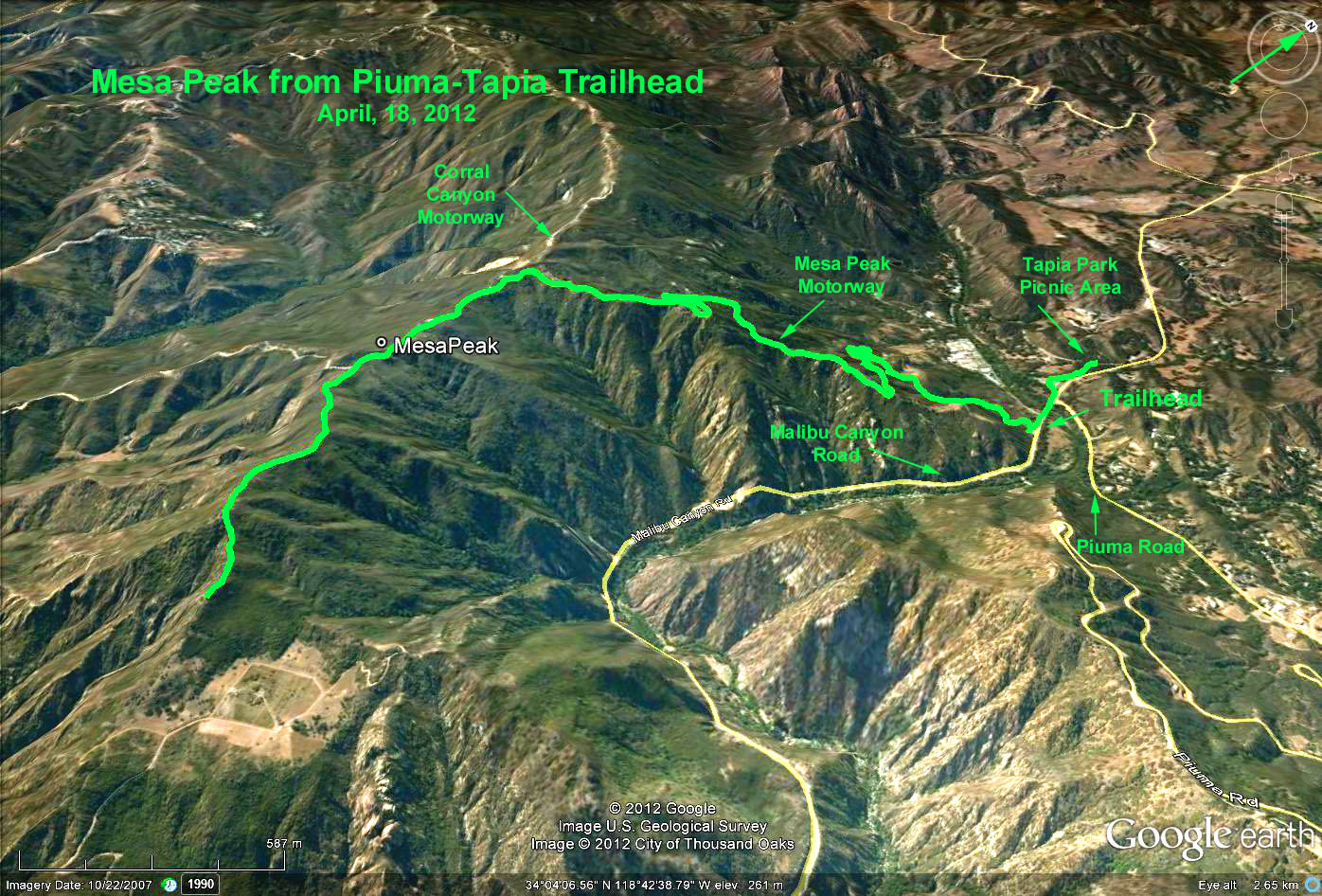
Directions to Trailhead: The trail head is located on the west side of the parking lot which is 1/4 mile south of Piuma Rd on the west side of Malibu Canyon Rd. The trail head can be reached from either Pacific Coast Hwy or the Ventura Fwy (101) via the Las Virgenes Canyon Hwy. which becomes Malibu Canyon Rd. NOTE: This is a state park and a $9 fee is charged. There is also free parking on Piuma Rd. There is a restroom located at the beginning of the trail.
The Hike: The trail begins on the west side of the parking lot and ascends abruptly just past the toilet. The trail is eroded with stretches of roly-poly rocks so be advised to bring your hiking sticks. At about 0.6 miles the trail joins Mesa Peak Motorway a fire road. Go LEFT UPHILL. Continue along the fire road for about 2 miles to a junction with a road descending on the left. This is the turn-around place for the SHORT HIKE. Return the way you came.
For those going to MESA PEAK, take the road downhill for about 1/2 mile where the road makes a reasonably sharp right turn downhill. Here, leave the road and take the trail uphill directly across the road near the sign that reads that access is restricted. Follow this trail for another 1/2 mile where the trail descends steeply to the south. This is Mesa Peak which affords a view of Pepperdine University and the ocean. Return the way you came.
For those who wish to extend the hike, continue past the junction for as far as you want to go. This segment of the Backbone Trail ends in the Corral Canyon parking lot. Return the way you came.
Google Earth photo - Meas Peak from Tapiz (Piuma Rd.) Trailhead
GPS Data:
Short Hike: 5.1 mi. RT
To Mesa Peak: 6.0 mi. RT
Extension beyond Mesa Peak: 7.7 mi. RT
(Segment from Trailhead to Tapia Picnic Area = 0.4 mi. not included)
Max. Elevation = 1400 ft. (at junction with Corral Canyon Motorway).