Distance: 7.4 miles RT.
Elevation Loss: 1000 ft.
Description: This hike in the San Mateo Wilderness area is along and above the stream in Tenaja Canyon, gently down and then up upon return. It's a very pleasant hike with hills, stream, plant and bird varieties, and sun and shade.
Directions to Trailhead: Go the best way from your area to the intersection of the Riverside Freeway (State 91) and Interstate 15. Take Interstate 15 south. In about 28 miles, exit and turn right (south) onto Clinton Keith Road. Proceed south on Clinton Keith Road which changes its name after about five miles to Tenaja Road. Stay on Tenaja Road, as it makes various turns. Stay on Clinton Keith/Tenaja Road for 12.3 miles from the 15 Freeway off-ramp and then turn right on a one-lane, paved Cleveland Forest Road for almost another mile. The trailhead parking area is just north of the Tenaja Station. Parking is free but may require a US Forest Service or Golden Age Pass. There are non-flushing restrooms and one or two picnic tables. A hiking trail map is displayed at the trailhead. The Tenaja Canyon trail starts to the right of the sign/display.
The Hike: The Tenaja Canyon Trail is about 3.7 miles to Fisherman's Camp, and descends gently for about a 900 ft. loss of elevation, returning the way we came. The trail is a very pleasant walk alternately along or up to 400 ft. above the stream at the base of the canyon. The canyon is nicely vegetated with trees and bushes, and views of the adjacent hills are generally visible, and there are lovely views of the canyon. There are two stream crossings, one at about 2.5 miles, and one at 2.8 miles.
Hike Options: For the rabbits, there are (at least) two trails from Fisherman Camp. One trail (San Mateo Trail) goes to Tenaja Falls in 1.0 mile, and another goes to Bluewater Falls in 1.7 miles. For hikers wishing to hike fewer miles, it is convenient to stop and return to the trailhead anywhere along the Tenaja Canyon Trail.
Refreshments: We will use the picnic table(s) at the parking area near the trailhead.
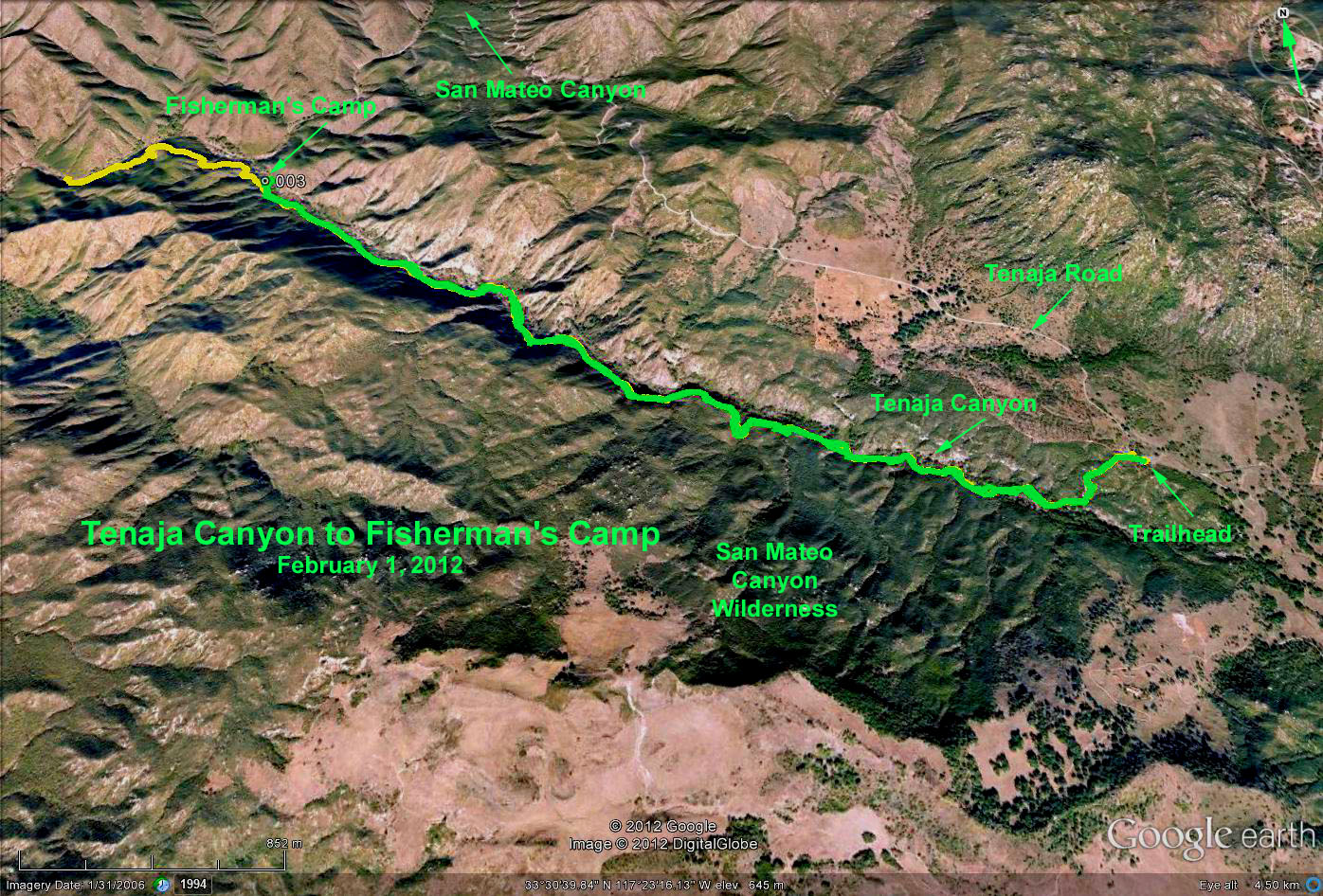
Google Earth Photo - Tenaja Canyon - Fishermam's Camp
GPS Data:
Basic Hike to Fisherman's Camp (green trace): 7.3 mi RT; max elevation change= 850 ft.
Extra Hike to Bluewater Junction (yellow trace): 9.5 mi RT; max elevation change = 950 ft.