Distance - San Juan Hill: 5.5 miles RT, 1000 ft. elevation gain
Gilman Peak : 6 miles RT, 1000 ft. elevation gain
Directions to Trailhead: Take the 57 south (or north as applicable) and exit on Imperial Highway, go east 3 miles to Bastanchury Road. Turn left and go 2.7 miles to Fairmont Blvd. Turn left 0.8 mile to Rimcrest Dr. Turn left and go 0.4 mile to dead end. Park on the right side of the street.
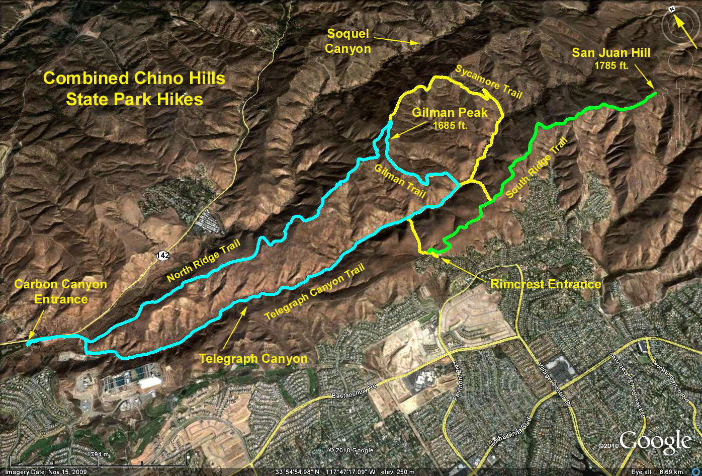
Summary: Two hikes are proposed, one to San Juan Hill, and the other to Gilman Peak. Given time contraints, it might be possible to do both.
The hike to San Juan Hill: Starting at the trailhead signboard, a short walk north gives access to the South Ridge trail. Turn right and proceed some 3 miles to a dirt path which climbs the peak of San Juan Hill. Along the way, bypass the junction with the Little Canyon Trail about 0.75 miles out from the trailhead. Return the way you came.
The Gilman Peak Double Loop: Starting at the trailhead signboard, continue north along the Easy Street trail down into Telegraph Canyon. Turn right on the Telegraph Canyon trail and proceed some 2 miles to the Sycamore trail leading off to the left and up-canyon bypassing the intersection of the Gilman and Little Canyon trails along the way. Turn left on the Sycamore trail and make your way up out of Telegraph Canyon to junction with the North Ridge trail. Turn left on the North Ridge trail and again left onto the Gilman trail climbing to the peak.
After surveying a sweeping view of Orange County, continue south on the Gilman trail back down into Telegraph Canyon, crossing the Telegraph Canyon trail and climbing out of the canyon on the Little Canyon Trail. Upon reaching the South Ridge trail, turn right and proceed back to the trailhead.
Refreshments at the trailhead.
Google Earth Photo - Chino Hills State Park
GPS Data:
San Juan Hill
RT = 5.2 mi.
Max Elevation Change = 780 ft.
Gilman Peak:
RT = 6.4 mi.
Max Elevation Change = 860 ft.