Distance: 7.4 miles RT
Elevation gain: = 1600 ft.
Directions to Trailhead: 210 Freeway; exit to Baseline Road. Turn left on Baseline Road for one block and turn right on Padua Avenue. In 1.7 miles turn right on Baldy Road. Continue up Baldy Road almost to the end and park at the San Antonio Falls turnoff. No restroom at the trailhead.
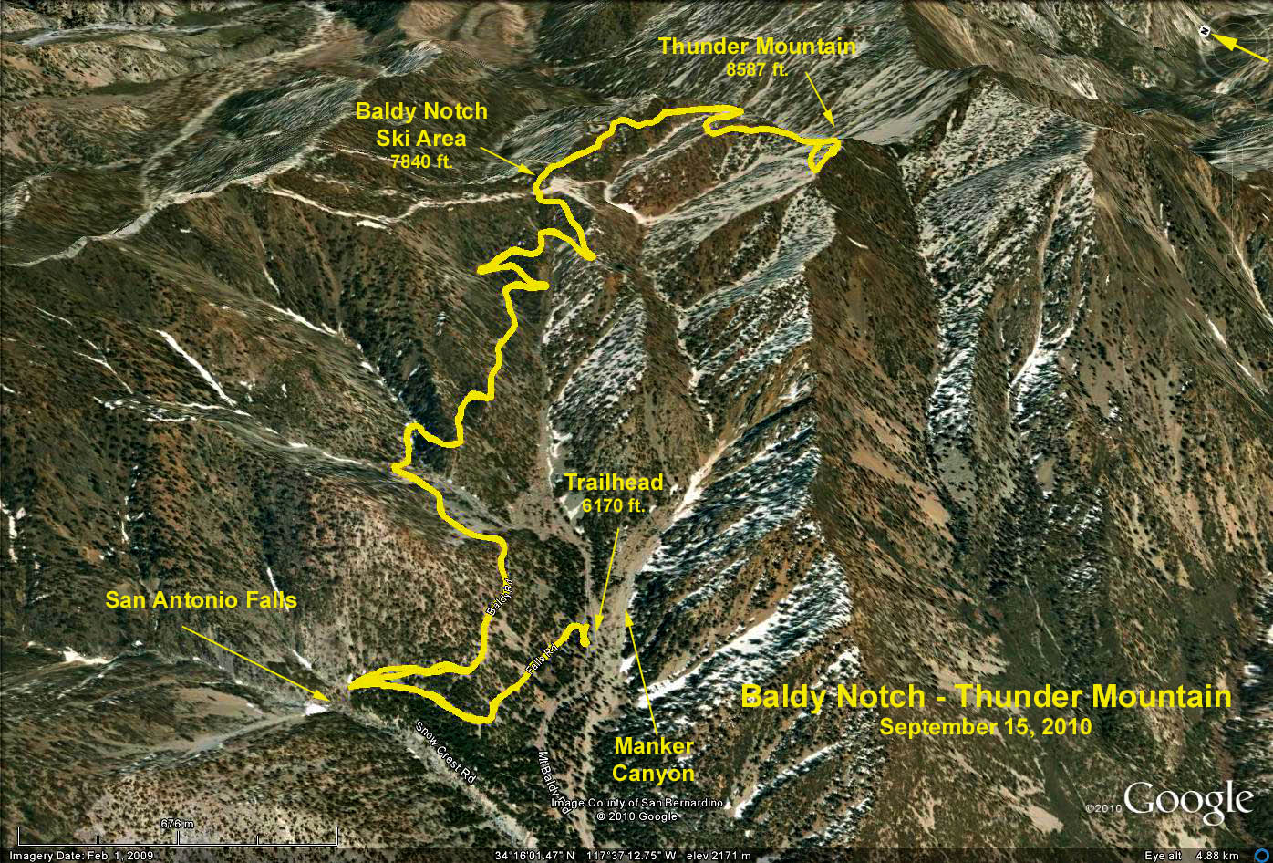
The Hike: We hike past the locked gate up the San Antonio Falls Road. The road is paved for about .6 miles to the falls. At the falls the road makes a sharp right and becomes a dirt road the rest of the way to the notch. At about 7600 ft elevation, near the notch there is a Y. Take the left fork to the Restaurant. You can see the Restaurant from here. From the Restaurant, walk a few hundred yards east up a dirt road to Desert View. Return the same way.
Options:
1) Ski Hut. A short distance from the falls down the dirt road there is a steep unsigned trail on the left that leads to the Sierra Club Ski Hut. Adds 2.5 miles and 600 ft.
2)Thunder Mountain: From Desert View follow the fire road southeast up Gold Ridge to Thunder Mountain. Adds 2.6 miles and 900 ft.
Refreshments at the trailhead.
Google Earth Photo - San Antonio Falls/Baldy Notch
GPS Data
RT = 9.5 miles to Thunder Mountain
Elevation gain = 2400 ft.