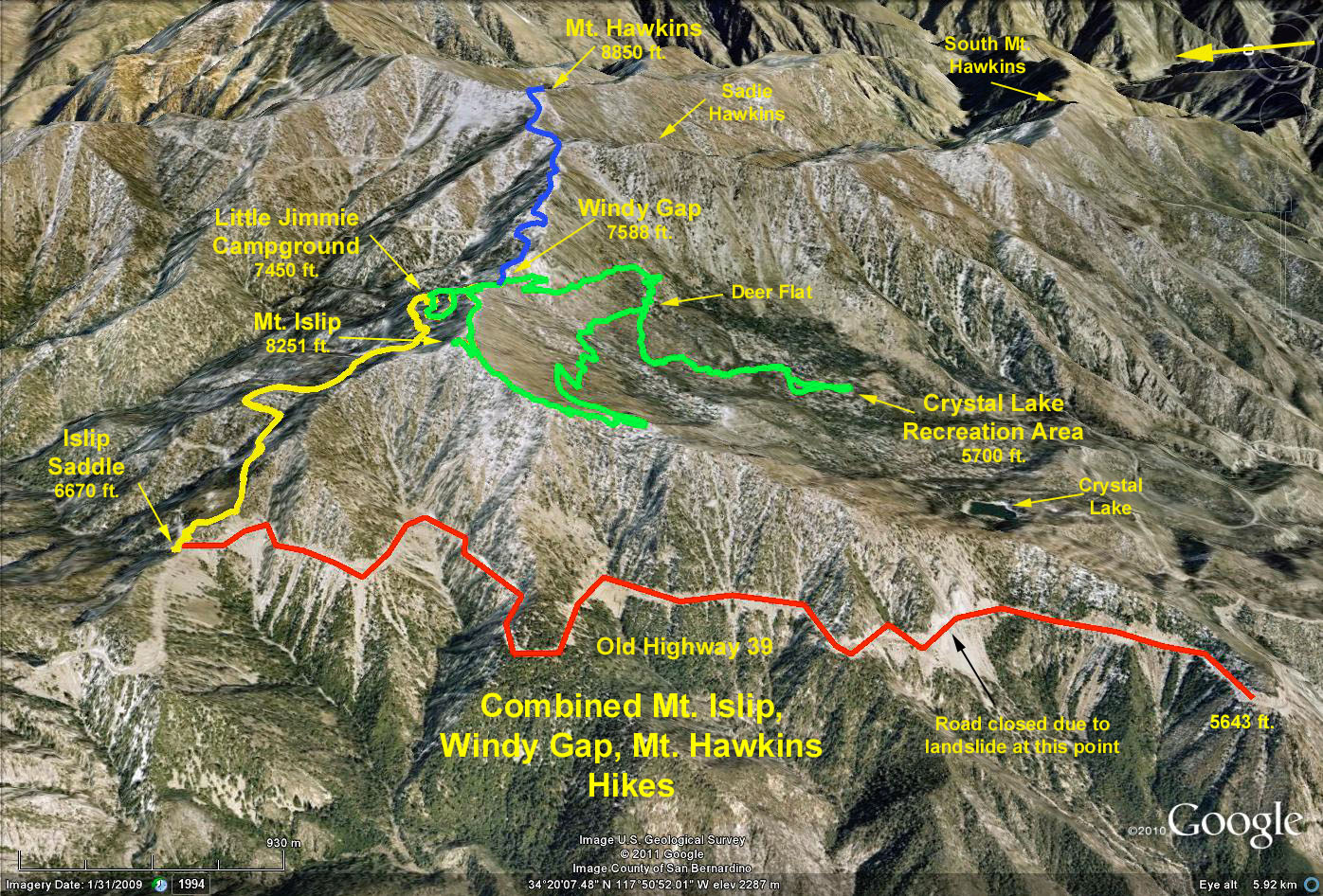
CAUTION: This hike (last attempted 16 October 1991) is no longer scheduled because of the danger of crossing the slide area.
Distance: 9 mi. RT
Elevation Gain: 900 ft.
Directions to Trailhead: Turn north from the 210 Freeway on Azusa Avenue (Rte. 39), drive through Azusa and continue north on San Gabriel Canyon Road. Proceed to the Crystal Lake turnoff at about 26 miles from the freeway, turn left (do not go to Crystal Lake) and proceed a short distance to where the road is blocked with large boulders. Park in the parking area near the end of the road. Allow about 45 minutes driving time from the 210 freeway.
The Hike: We hike the remnant of State Route 39 from about 1.4 miles above the Crystal Lake turn off to the junction with the Angeles Crest Highway, State Route 2 at Islip Saddle. This section of the road has been closed to automobile traffic since the late '70s due to the washout of the road during a heavy rainfall.
Google Earth Photo - Islip Saddle via Highway 39
GPS Data:
RT = 8.8 mi.
Max Elevation Change = 1025 ft.