Distance: 7.5 miles round trip.
Elevation gain = 1660 ft.
Directions to Trailhead: Meet at the site of the old Wickiup Campground in Upper Big Tujunga Canyon. To get there from the I-210 Freeway drive up the Angeles Crest Highway to Clear Creek Junction, then left on the Angeles Forest Highway to the junction of the Upper Big Tujunga Road, mileage paddle 16.56. Go right on Upper Big Tujunga Road to mileage paddle 1.28 and turn right (the sign says Methodist Camp Colby). Drive down this narrow winding paved road .8 mile to a large paved parking lot on the left just after crossing a steel truss bridge over the creek. Note: The total distance from the 210 is about 20 miles. For hikers coming from the Valley, come up Big Tujunga Canyon Road from Sunland to the Angeles Forest Highway. There is a portable toilet at the parking lot.
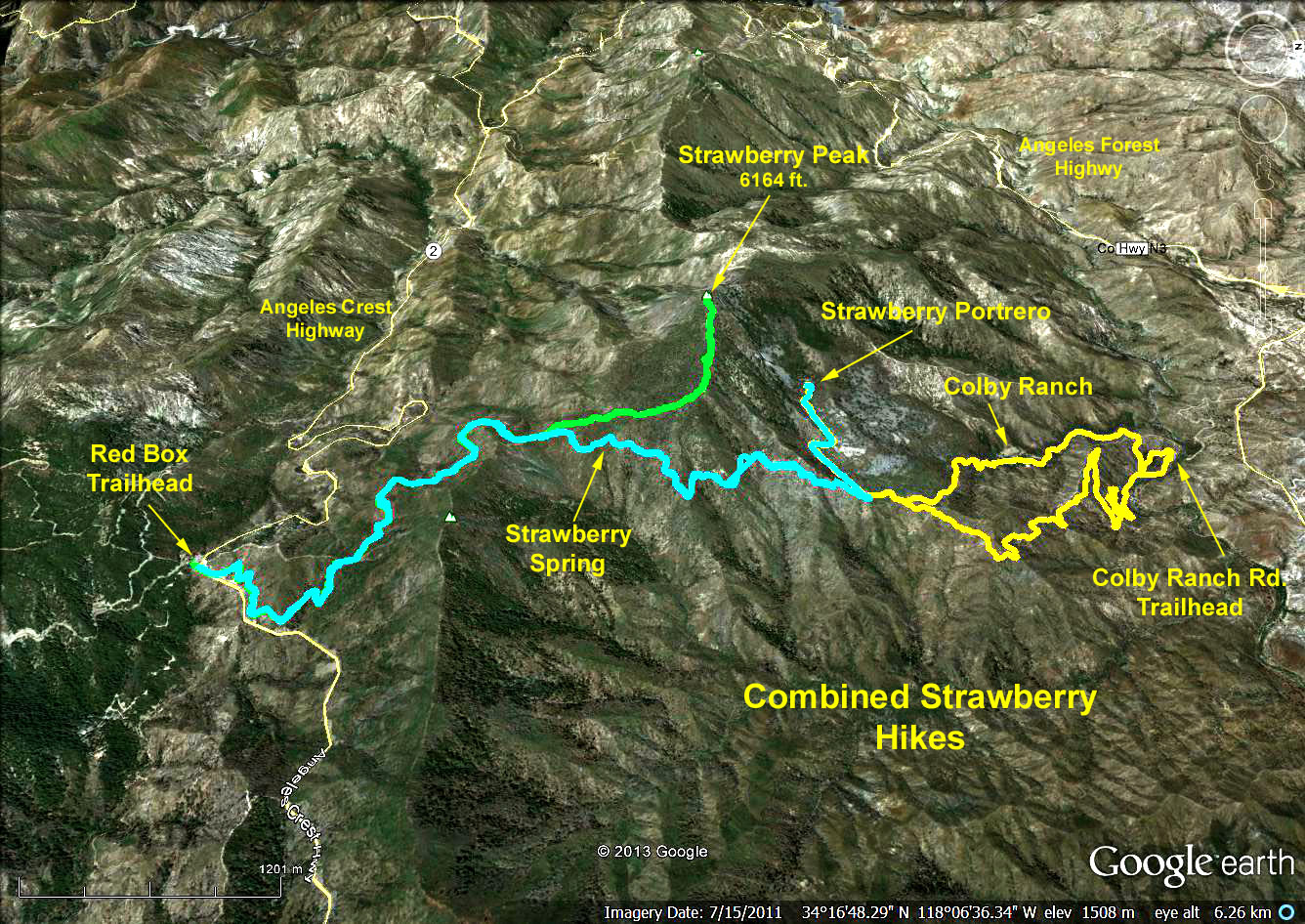
Summary: This hike uses the new bypass trail to allow hikers to get all the way to the bank of Big Tujunga Canyons creek from Strawberry Potrero (potrero means pasture in Spanish). Formerly, the trail coming down ended at the private Colby Methodist Camp. It is 1600 feet up to Strawberry Potrero and when we come down, there is a 60 foot up hill near the end for a total gain of 1660 feet. There is only a smattering of poison oak, which is easily avoided, however, in several places the trail is overgrown with scratchy brush, so wearing long pants is recommend.
The Hike: We start our hike at the east end of the paved parking lot. The trail follows the creek for about 100 yards then heads south up and over a ridge and back down to the stream. After that initial up and down we head steadily up on a well graded trail with some short and long switchbacks. In a few places the trail is a little thin due to washouts, but quite passable.
After 2 miles we reach a 120 yard stretch of steep uphill on a fire break. At about 2.5 miles we come around a ridge and suddenly have an outstanding view of the north face of Strawberry Peak. Continuing, we pass the unmarked trail down to the Methodist camp and finally arrive at the junction to Strawberry Potrero. We then contour west on a good trail along the base of the talus slope below Strawberry Peak through the lower and middle meadows until we reach our destination, Strawberry Potrero, at 3.75 miles, where we will have lunch.
Return to the trailhead either by retracing your steps, or else take the trail to Colby Methodist Camp road and return via the road.
Original 1998-09-02 Hike Description
Google Earth photo - Combined Strawberry Hikes
GPS Data:
One way out via trail = 3.7 mi.
One way back via trail/road = 3.0 mi.
Max Elevation change = 1540 ft.
2017-07-02